
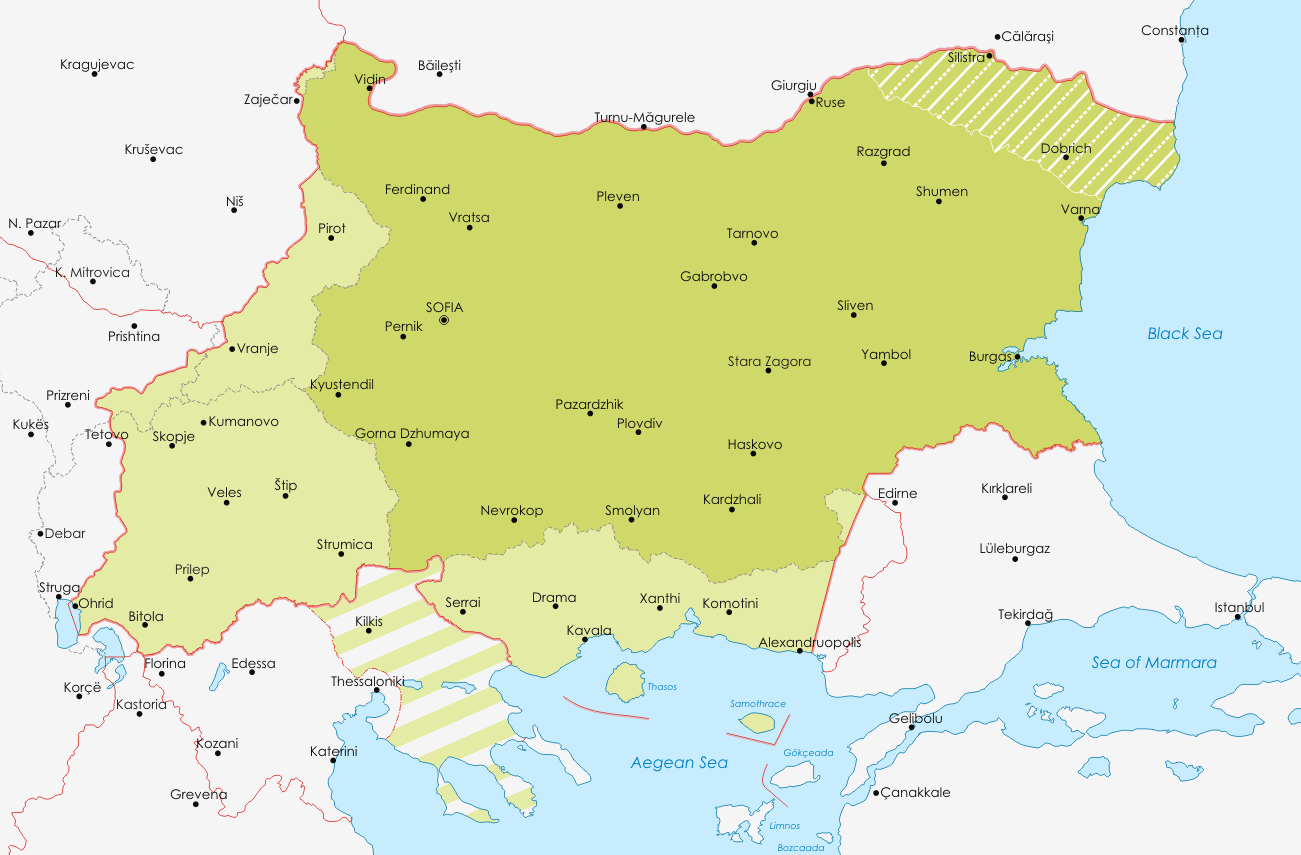
Image: Map of Bulgaria during WWII
Size of this preview: 800 × 526 pixels. Other resolutions: 320 × 210 pixels | 1,301 × 855 pixels.
Original image (1,301 × 855 pixels, file size: 83 KB, MIME type: image/png)
Description: Map of Bulgaria during WWII
Title: Map of Bulgaria during WWII
Credit: Гоцев Д. Из документалните записки на ОЗ подполковник Вълко Антонов Яначков за териториалното разграничение между България и Италия във Вардарска Македония 1942-1943, сп. Македонски преглед, бр.3/2004; anamnesis.info-The_Occupation_of_Greece_1941-1944
Author: Пакко
Usage Terms: Creative Commons Attribution-Share Alike 3.0
License: CC BY-SA 3.0
License Link: https://creativecommons.org/licenses/by-sa/3.0
Attribution Required?: Yes
Image usage
The following page links to this image:

All content from Kiddle encyclopedia articles (including the article images and facts) can be freely used under Attribution-ShareAlike license, unless stated otherwise.