
Image: Map of Chatham, Kent, 1890
Size of this preview: 646 × 600 pixels. Other resolutions: 258 × 240 pixels | 785 × 729 pixels.
Original image (785 × 729 pixels, file size: 462 KB, MIME type: image/png)
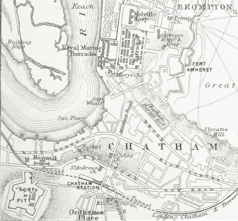
Description: ǃ890s map of Chatham, Kent. Shows relative position of Fort Amherst, Royal Marine Barracks, Fort Pitt and Chatham railway station.
Title: Map of Chatham, Kent, 1890
Credit: 1890s map of Central Chatham. Original publisher not known.
Author: Unknown authorUnknown author
Usage Terms: Creative Commons Attribution-Share Alike 4.0
License: CC BY-SA 4.0
License Link: https://creativecommons.org/licenses/by-sa/4.0
Attribution Required?: Yes
Image usage
The following page links to this image:

All content from Kiddle encyclopedia articles (including the article images and facts) can be freely used under Attribution-ShareAlike license, unless stated otherwise.