
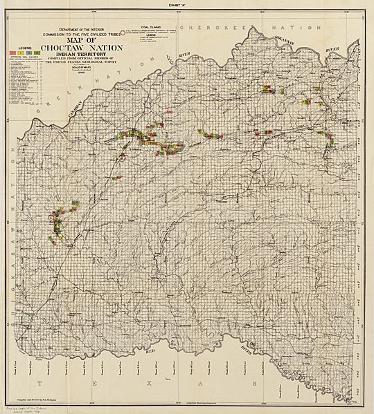
Image: Map of Choctaw Nation, Indian territory - compiled from official records of the United States Geological Survey LOC 2007627519

Description: At head of sheet: Exhibit "A". Includes approved coal leases and coal claims. From: United States. Dept. of the Interior. Secretary's annual statement and report to the President and the Congress, 1902. Available also through the Library of Congress Web site as a raster image.
Title: Map of Choctaw Nation, Indian territory - compiled from official records of the United States Geological Survey LOC 2007627519
Credit: https://www.loc.gov/item/2007627519/
Author: Mcalpine, R. L.; United States. Department Of The Interior
Permission: This map is available from the United States Library of Congress's Geography & Map Division under the digital ID g4022c.ct002096. This tag does not indicate the copyright status of the attached work. A normal copyright tag is still required. See Commons:Licensing for more information.
Usage Terms: Public domain
License: Public domain
Attribution Required?: No
Image usage
The following page links to this image:
