
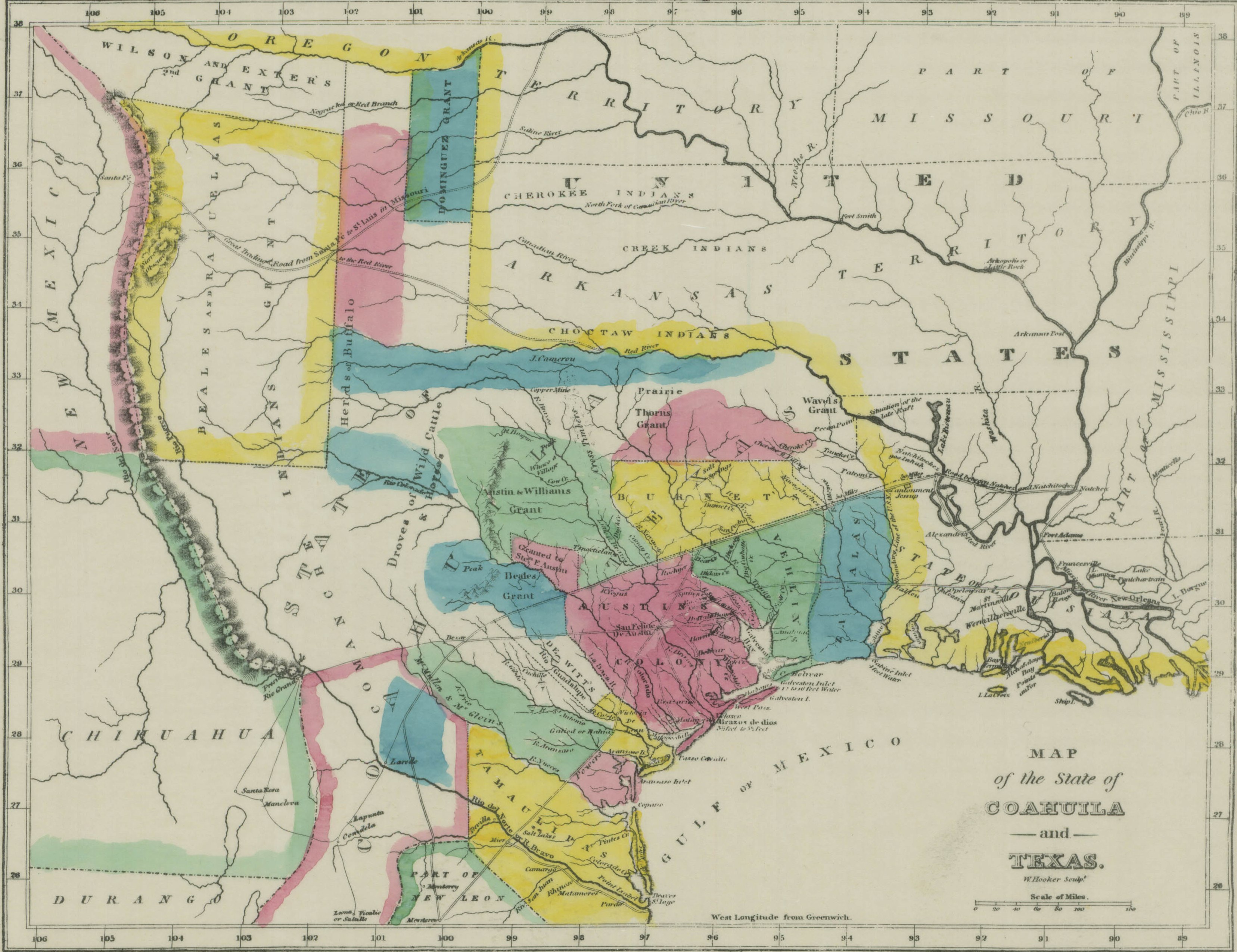
Image: Map of Coahuila and Texas in 1833
Description: This is a map showing the Mexican province of Coahuila and Texas in 1833.
Title: Map of Coahuila and Texas in 1833
Credit: The scanned image is taken from https://www.tsl.texas.gov/cgi-bin/aris/maps/maplookup.php?mapnum=1607b, where it says the map was originally published in Texas, by Mary Austin Holley (Armstrong & Plaskitt, Baltimore, 1833). Uploaded to en:Wikipedia by Karanacs (log).
Author: Holley (Armstrong & Plaskitt)
Permission: This image might not be in the public domain outside of the United States; this especially applies in the countries and areas that do not apply the rule of the shorter term for US works, such as Canada, Mainland China (not Hong Kong or Macao), Germany, Mexico, and Switzerland. The creator and year of publication are essential information and must be provided. See Wikipedia:Public domain and Wikipedia:Copyrights for more details.
Usage Terms: Public domain
License: Public domain
Attribution Required?: No
Image usage
The following page links to this image:
