
Image: Map of Cocos from Pacific Islands, vol. 2 (Geographical Handbook Series, 1943)
No higher resolution available.
Map_of_Cocos_from_Pacific_Islands,_vol._2_(Geographical_Handbook_Series,_1943).jpg (646 × 555 pixels, file size: 77 KB, MIME type: image/jpeg)
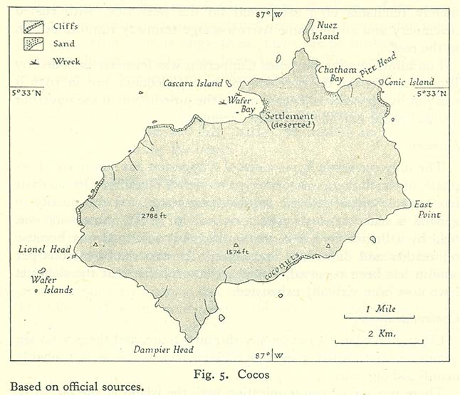
Description: A map of Cocos Island (Isla del Coco), Costa Rica. The caption of the map is: "Fig. 5. Cocos / Based on official sources."
Title: Map of Cocos from Pacific Islands, vol. 2 (Geographical Handbook Series, 1943)
Credit: Map Collection of the Perry-Castañeda Library, University of Texas. Originally from (1943) Pacific Islands: 2, Eastern Pacific, Nov. 1943 [Geographical handbook series; B.R. 519a], London: Naval Intelligence Division OCLC: 310446759. [1]
Author: Naval Intelligence Division, Admiralty (UK).
Usage Terms: Public domain
License: Public domain
Attribution Required?: No
Image usage
The following page links to this image:

All content from Kiddle encyclopedia articles (including the article images and facts) can be freely used under Attribution-ShareAlike license, unless stated otherwise.
.jpg)