
Image: Map of Colchis, Iberia, Albania, and the neighbouring countries ca 1770
Size of this preview: 800 × 598 pixels. Other resolutions: 320 × 239 pixels | 1,016 × 760 pixels.
Original image (1,016 × 760 pixels, file size: 194 KB, MIME type: image/jpeg)
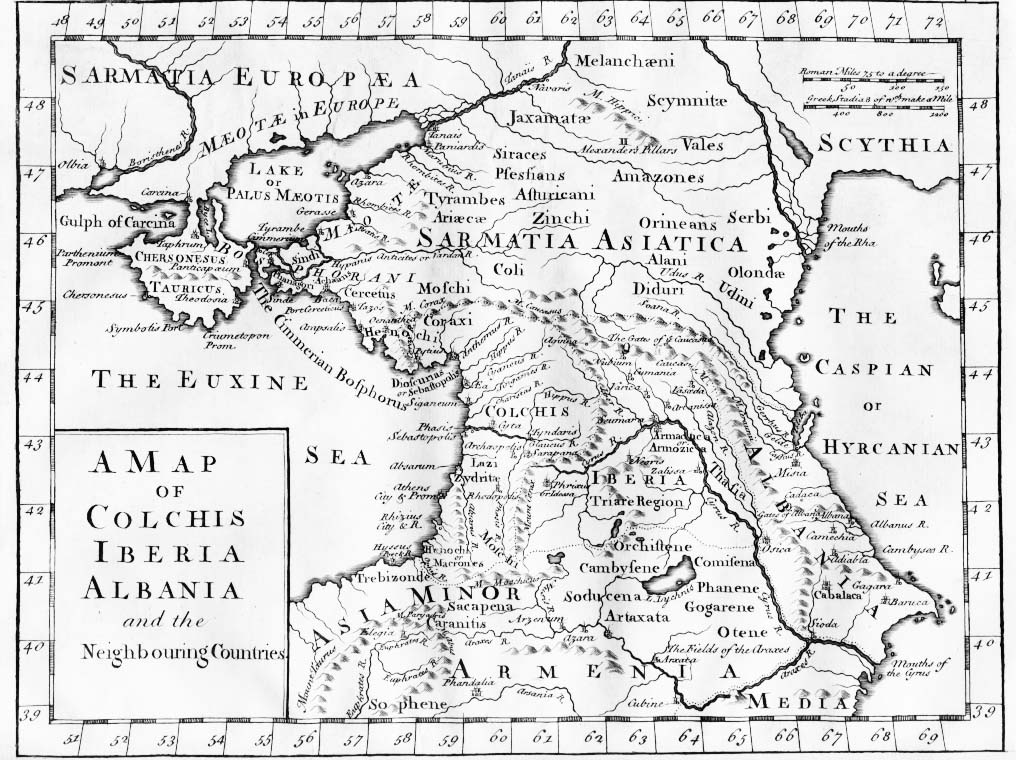
Description: "A Map of Colchis, Iberia, Albania, and the neighbouring countries". A map of the Caucasus / Crimea (Chersonesus Tauricus)/ southern Russia region during classical antiquity (the ancient period). Note that the "Albania" referred to was on the Caspian Sea (not the modern Albania in the Balkans). Copper-engraved map, no publisher or date, London, ca 1770 (or 1729?).
Title: Map of Colchis, Iberia, Albania, and the neighbouring countries ca 1770
Credit: www.village-atlas.com Original uploaded to en.wikipedia: en:Image:1729.jpg
Author: last upload en:User:AnonMoos
Usage Terms: Public domain
License: Public domain
Attribution Required?: No
Image usage
The following page links to this image:

All content from Kiddle encyclopedia articles (including the article images and facts) can be freely used under Attribution-ShareAlike license, unless stated otherwise.