
Image: Map of Gaza Strip with no-go zone 2012
Size of this preview: 497 × 600 pixels. Other resolutions: 199 × 240 pixels | 4,732 × 5,712 pixels.
Original image (4,732 × 5,712 pixels, file size: 4.93 MB, MIME type: image/jpeg)
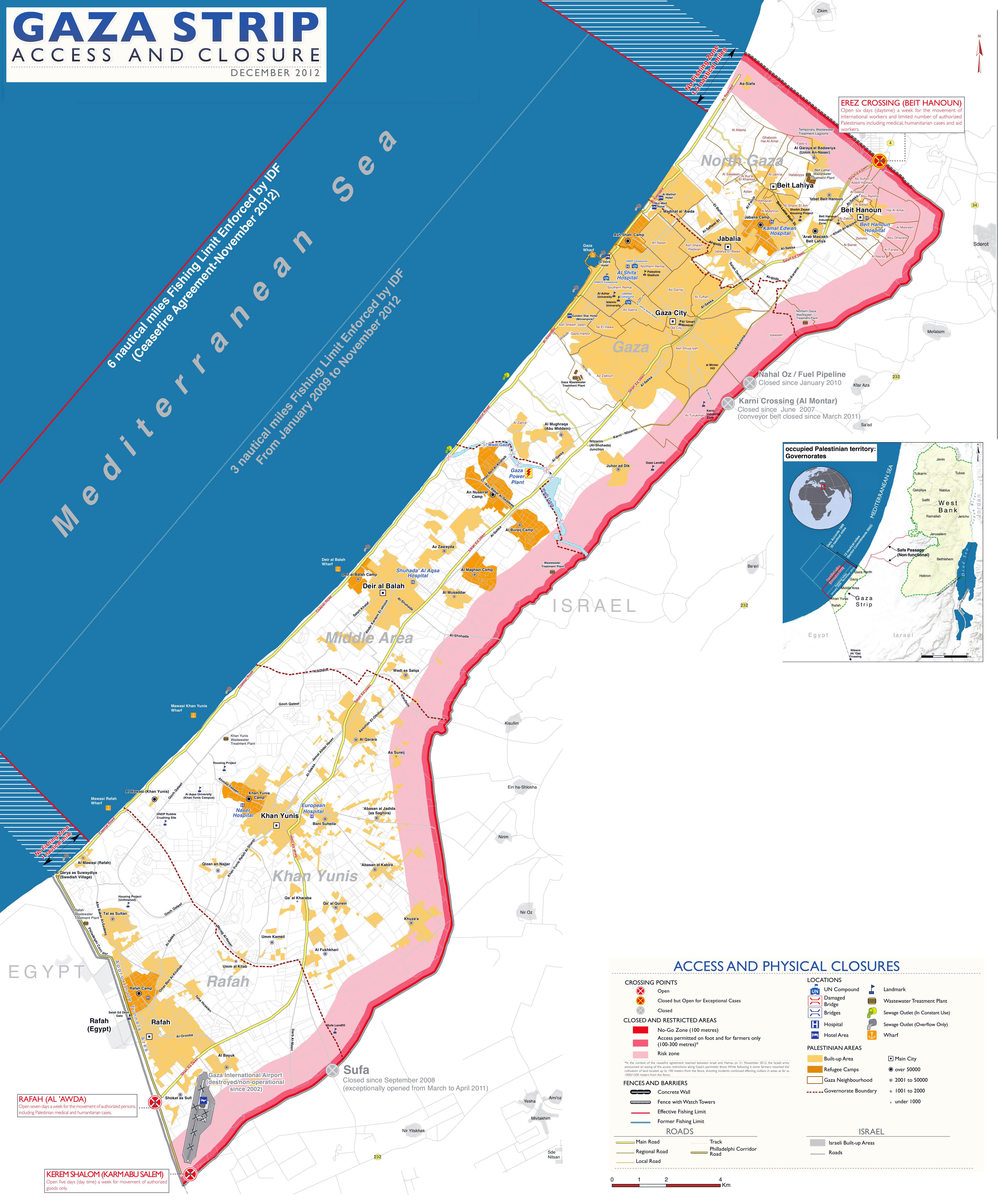
Description: Map of the Gaza Strip showing the border proximity restrictions with Israel as of 2012 No-go zone Access permitted by foot and by farmers only At-risk zone
Title: Map of Gaza Strip with no-go zone 2012
Credit: https://www.mapsland.com/asia/gaza-strip/large-scale-map-of-gaza-strip-with-roads-and-cities-2012
Author: Mapsland
Usage Terms: Creative Commons Attribution-Share Alike 3.0
License: CC BY-SA 3.0
License Link: https://creativecommons.org/licenses/by-sa/3.0
Attribution Required?: Yes
Image usage
The following page links to this image:

All content from Kiddle encyclopedia articles (including the article images and facts) can be freely used under Attribution-ShareAlike license, unless stated otherwise.