
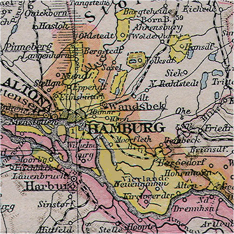
Image: Map of Hamburg city state 1890
Size of this preview: 598 × 599 pixels. Other resolutions: 240 × 240 pixels | 968 × 970 pixels.
Original image (968 × 970 pixels, file size: 1.07 MB, MIME type: image/jpeg)
Description: Map of the Free and Hanse City of Hamburg, a member state of the Holy Roman Empire, Germanic Confederation and German Empire. Map in 1890. Boundaries were changed in 1937
Title: Map of Hamburg city state 1890
Credit: Original publication: Allgemeiner Handatlas, published by Velhagen & Klasing, Bielefeld and Leipzig Immediate source: This is a digital enhanced extract of the north German page, by myself
Author: Richard Andree (Life time: 1835-1912)
Permission: Copyright expired as taken from book published in 1890
Usage Terms: Public domain in the United States
License: PD-US
License Link: //en.wikipedia.org/wiki/File:Map_of_Hamburg_city_state_1890.jpg
Image usage
The following page links to this image:

All content from Kiddle encyclopedia articles (including the article images and facts) can be freely used under Attribution-ShareAlike license, unless stated otherwise.