
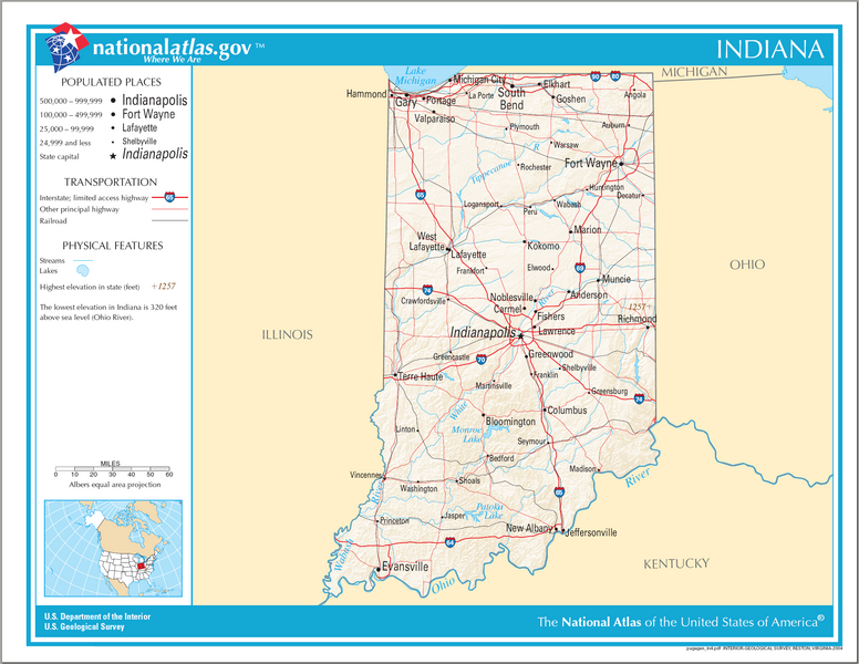
Image: Map of Indiana NA

Size of this preview: 776 × 600 pixels. Other resolutions: 311 × 240 pixels | 2,122 × 1,640 pixels.
Original image (2,122 × 1,640 pixels, file size: 704 KB, MIME type: image/png)
Description: Reference Map of Indiana.
Title: Map of Indiana NA
Credit: National Atlas of the United States Page: http://www.nationalatlas.gov/printable/reference.html#Indiana Map: http://www.nationalatlas.gov/printable/images/pdf/reference/pagegen_in.pdf
Author: National Atlas of the United States
Permission: Public domain
Usage Terms: Public domain
License: Public domain
Attribution Required?: No
Image usage
The following page links to this image:

All content from Kiddle encyclopedia articles (including the article images and facts) can be freely used under Attribution-ShareAlike license, unless stated otherwise.