
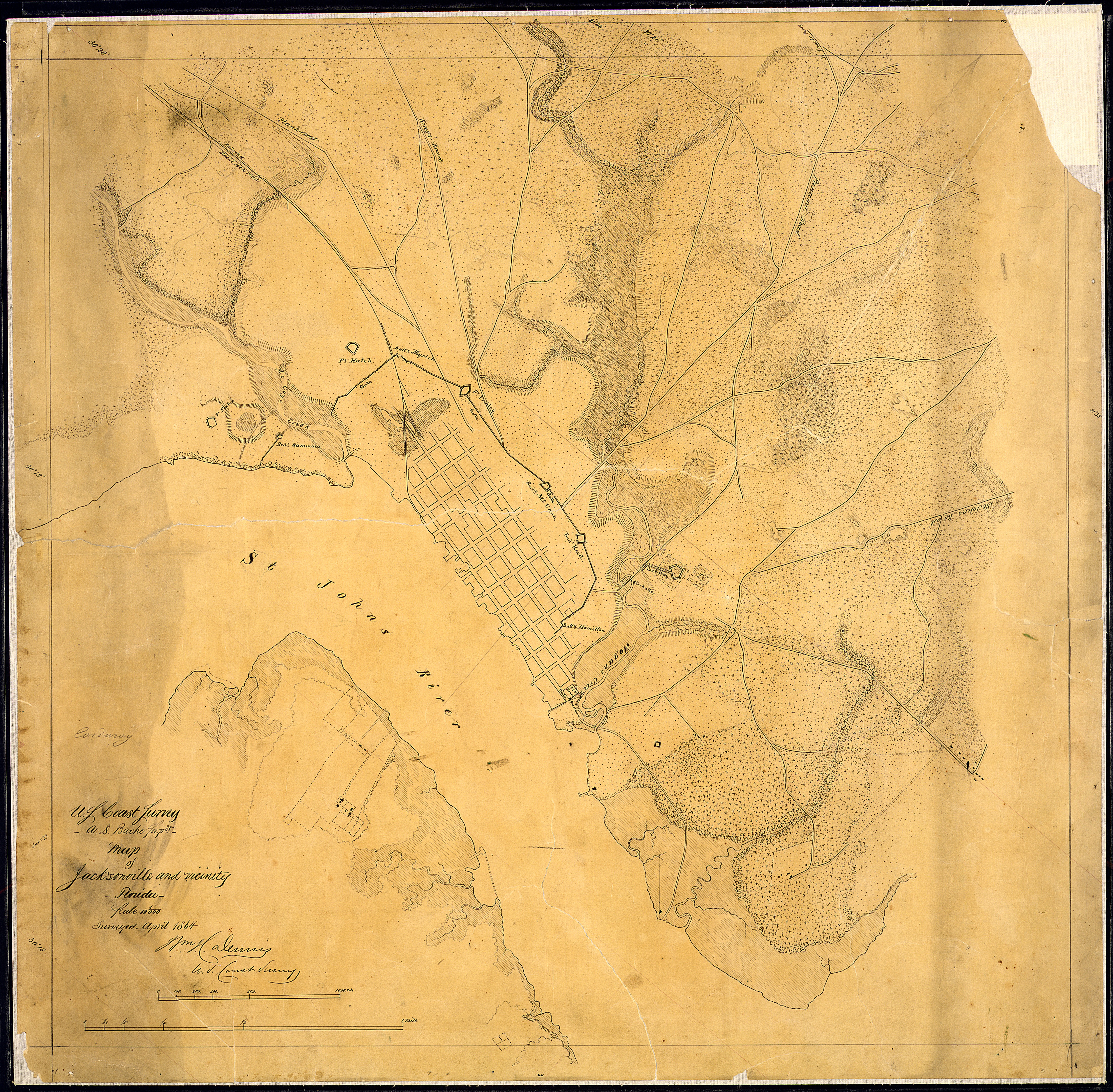
Image: Map of Jacksonville and vicinity, Florida, (showing defenses). Surveyed April 1864. (Signed) Wm. H. Dennis, U. S.... - NARA - 305631
Size of this preview: 611 × 600 pixels. Other resolutions: 245 × 240 pixels | 4,400 × 4,319 pixels.
Original image (4,400 × 4,319 pixels, file size: 7.82 MB, MIME type: image/jpeg)
Title: Map of Jacksonville and vicinity, Florida, [showing defenses]. Surveyed April 1864. [Signed] Wm. H. Dennis, U. S. Coast Survey.
Credit: U.S. National Archives and Records Administration
Author: Unknown or not provided
Usage Terms: Public domain
License: Public domain
Attribution Required?: No
Image usage
The following page links to this image:

All content from Kiddle encyclopedia articles (including the article images and facts) can be freely used under Attribution-ShareAlike license, unless stated otherwise.
._Surveyed_April_1864._(Signed)_Wm._H._Dennis,_U._S...._-_NARA_-_305631.jpg)