
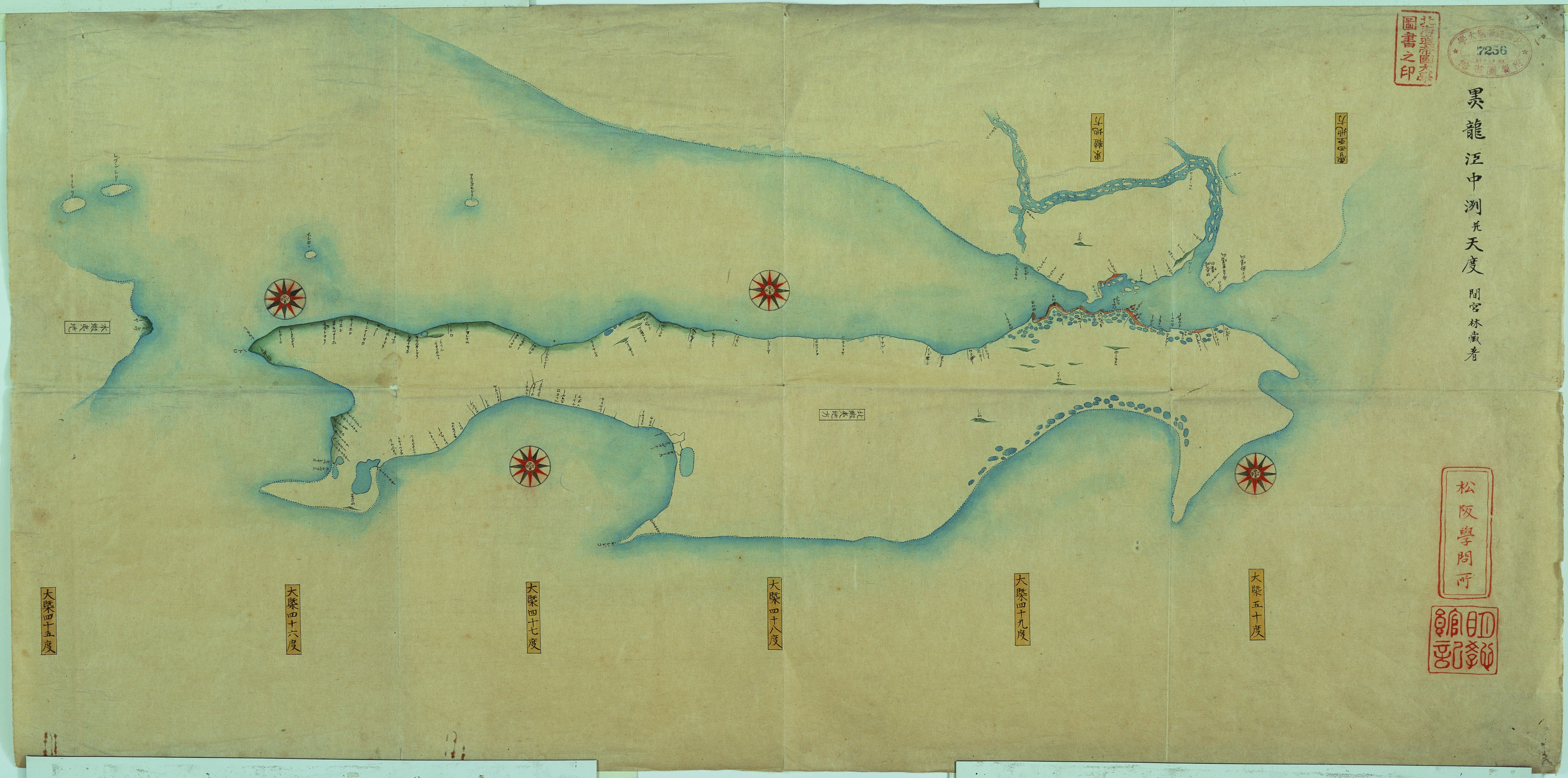
Image: Map of Karafuto and the Amur estuary by Mamiya Rinzo (1810)/間宮林蔵『黒竜江中州并天度』(文化7年)
Size of this preview: 800 × 397 pixels. Other resolutions: 320 × 159 pixels | 8,000 × 3,968 pixels.
Original image (8,000 × 3,968 pixels, file size: 25.71 MB, MIME type: image/jpeg)
Description: It was the first map that describes Karafuto (Sakhalin) as an island.
Title: Map of Karafuto and the Amur estuary by Mamiya Rinzo (1810)/間宮林蔵『黒竜江中州并天度』(文化7年)
Credit: Courtesy of Hokkaido University Northern Studies Collection 北海道大学北方資料データベース(https://www2.lib.hokudai.ac.jp/hoppodb/)
Author: Mamiya Rinzo 間宮林蔵
Usage Terms: Creative Commons Zero, Public Domain Dedication
License: CC0
License Link: http://creativecommons.org/publicdomain/zero/1.0/deed.en
Attribution Required?: No
Image usage
The following page links to this image:

All content from Kiddle encyclopedia articles (including the article images and facts) can be freely used under Attribution-ShareAlike license, unless stated otherwise.
/間宮林蔵『黒竜江中州并天度』(文化7年).jpg)