
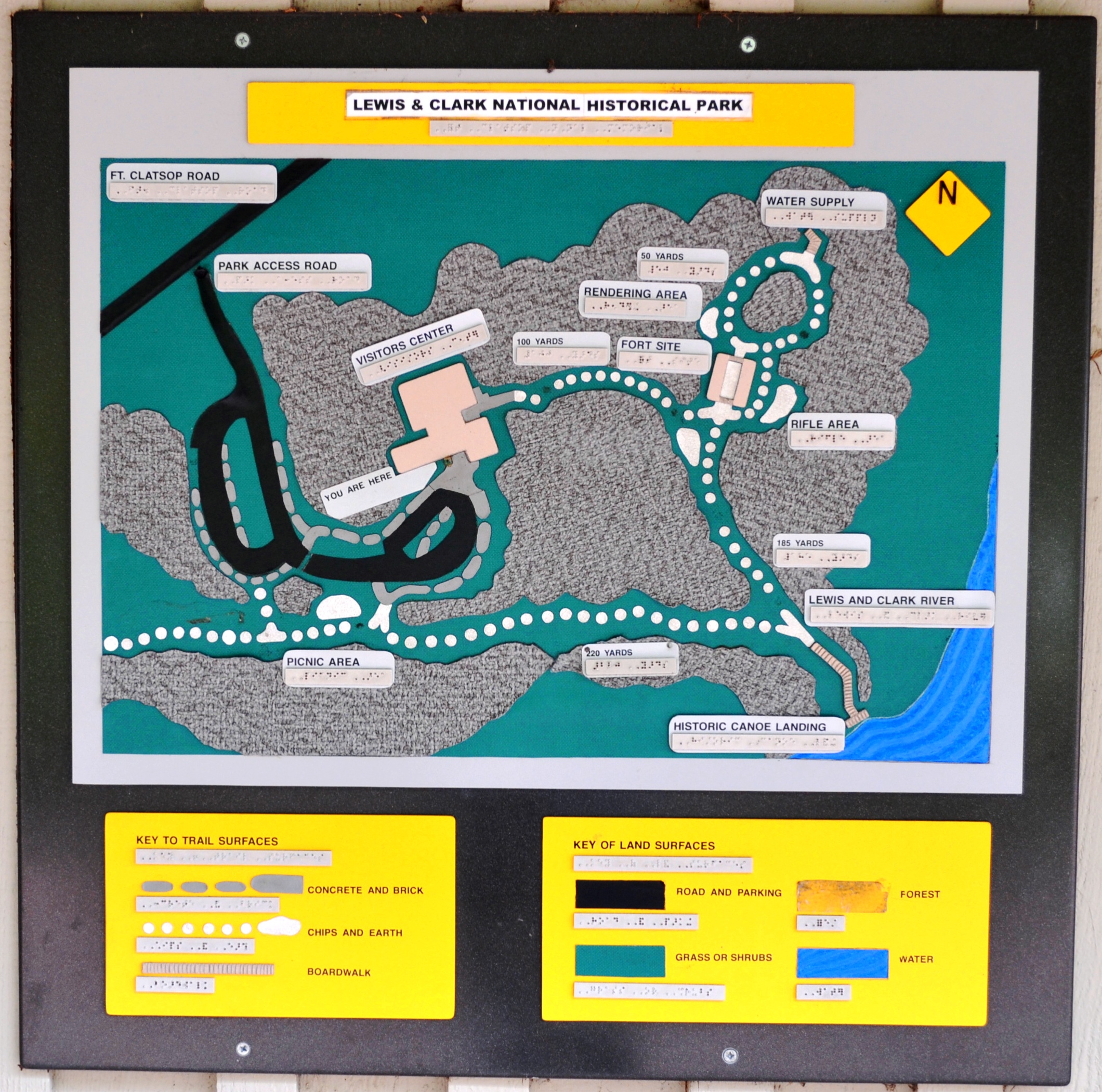
Image: Map of Lewis and Clark National Historic Park
Size of this preview: 605 × 600 pixels. Other resolutions: 242 × 240 pixels | 2,120 × 2,101 pixels.
Original image (2,120 × 2,101 pixels, file size: 1.58 MB, MIME type: image/jpeg)
Description: Map of Fort Clatsop — built by the Lewis and Clark Expedition during 1805 - 1806. Part of the Lewis and Clark National Historic Parks, located in Clatsop County, Oregon. Photo of map located outside the visitor center showing.
Title: Map of Lewis and Clark National Historic Park
Credit: Own work
Author: Sueswim03
Usage Terms: Creative Commons Attribution-Share Alike 3.0
License: CC BY-SA 3.0
License Link: https://creativecommons.org/licenses/by-sa/3.0
Attribution Required?: Yes
Image usage
The following page links to this image:

All content from Kiddle encyclopedia articles (including the article images and facts) can be freely used under Attribution-ShareAlike license, unless stated otherwise.