
Image: Map of Litbel 1919

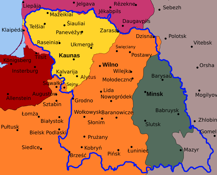
Description: Map of planned border (thick blue line) for the en:Lithuanian–Belorussian Soviet Socialist Republic (commonly known as Litbel) superimposed on state borders in 1920. Germany Latvia Poland Lithuania Socialist Soviet Republic of Byelorussia Klaipėda Region (detached from Germany by the Treaty of Versailles) Note: all cities have their current names, except for three cities in the Kaliningrad Oblast as their names were radically changed after the World War II.
Title: Map of Litbel 1919
Credit: Own work by uploader using Inkscape. Data is form Lietuvos istorijos atlasas (ISBN 5-415-01577-9)
Author: Renata3
Permission: Copyleft
Usage Terms: Creative Commons Attribution-Share Alike 3.0
License: CC BY-SA 3.0
License Link: http://creativecommons.org/licenses/by-sa/3.0
Attribution Required?: Yes
Image usage
The following 2 pages link to this image:
