
Image: Map of Loudoun County, Virginia LOC 2012589658
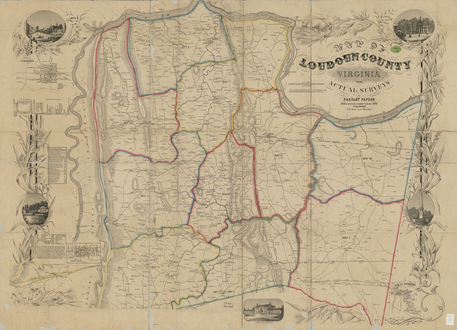
Description: Shows magisterial districts and names of some residents. Relief shown by hachures. "Edition A." "Entered according to act of Congress in the year 1853 by Robert Pearsall Smith in the Clerks Office of District Court of the Eastern District Court of Pennsylvania." Sheets pasted together in 20 sections, sectioned in 4, and mounted on cloth. LC Land ownership maps, 1287 Includes text, "Geological profile of Loudoun County," list of elevations, abbreviation list, insets of Leesburg, Middleburg, and Waterford, and col. ill. Available also through the Library of Congress Web site as a raster image. Copy imperfect: Losses along fold lines and torn along edges.
Title: Map of Loudoun County, Virginia LOC 2012589658
Credit: https://www.loc.gov/item/2012589658/
Author: Taylor, Yardley; Thomas Reynolds & Robert Pearsall Smith, Publishers
Permission: This map is available from the United States Library of Congress's Geography & Map Division under the digital ID g3883l.la001287. This tag does not indicate the copyright status of the attached work. A normal copyright tag is still required. See Commons:Licensing for more information.
Usage Terms: Public domain
License: Public domain
Attribution Required?: No
Image usage
The following page links to this image:
