
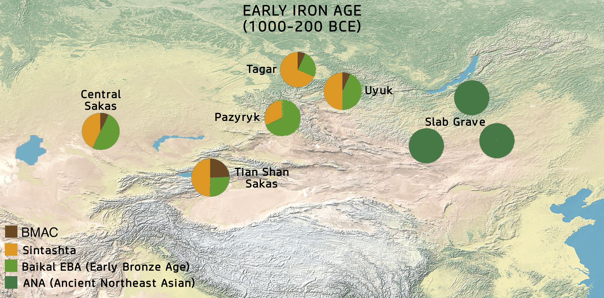
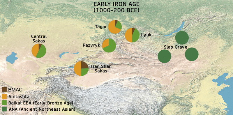
Image: Map of Mongolia (Early Iron Age)
Size of this preview: 800 × 395 pixels. Other resolutions: 320 × 158 pixels | 2,011 × 993 pixels.
Original image (2,011 × 993 pixels, file size: 2.16 MB, MIME type: image/png)
Description: Map of Mongolia (Early Iron Age)
Title: Map of Mongolia (Early Iron Age)
Credit: This file has been extracted from another file
Author: Background:naturalearthdata.com, offered to the Public Domain per Terms of Use Stats: Choongwon Jeong, Ke Wang Provided under CC BY 4.0: "Under a Creative Commons license (with link to CC BY 4.0 page)"
Usage Terms: Creative Commons Attribution-Share Alike 4.0
License: CC BY-SA 4.0
License Link: https://creativecommons.org/licenses/by-sa/4.0
Attribution Required?: Yes
Image usage
The following page links to this image:

All content from Kiddle encyclopedia articles (including the article images and facts) can be freely used under Attribution-ShareAlike license, unless stated otherwise.
.png)