
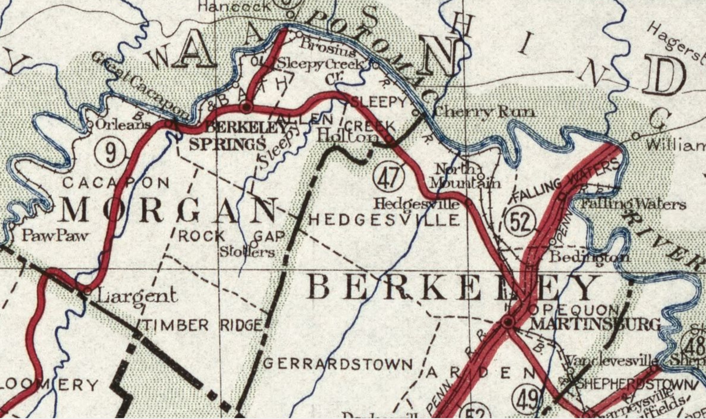
Image: Map of Morgan County in West Virginia
Size of this preview: 800 × 475 pixels. Other resolutions: 320 × 190 pixels | 2,373 × 1,410 pixels.
Original image (2,373 × 1,410 pixels, file size: 969 KB, MIME type: image/jpeg)
Description: Available also through the Library of Congress Web site as a raster image.
Title: Map of Morgan County in West Virginia
Credit: https://www.loc.gov/item/91681295/
Author: West Virginia. State Road Commission
Permission: This map is available from the United States Library of Congress's Geography & Map Division under the digital ID g3891p.ct009422. This tag does not indicate the copyright status of the attached work. A normal copyright tag is still required. See Commons:Licensing for more information.
Usage Terms: Public domain
License: Public domain
Attribution Required?: No
Image usage
The following page links to this image:

All content from Kiddle encyclopedia articles (including the article images and facts) can be freely used under Attribution-ShareAlike license, unless stated otherwise.