
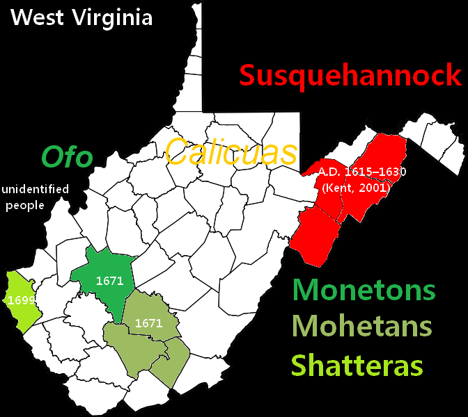
Image: Map of Native American locations in WV by county during the latter half of the 17th Century
No higher resolution available.
Map_of_Native_American_locations_in_WV_by_county_during_the_latter_half_of_the_17th_Century.png (672 × 600 pixels, file size: 36 KB, MIME type: image/png)
Description: Map of Native American locations in WV by county during the 17th C.
Title: Map of Native American locations in WV by county during the latter half of the 17th Century
Credit: File:Map of West Virginia highlighting Hampshire County.svg, modified
Author: This media: Conaughy (talk) (Uploads)
Permission: Public Domain
Usage Terms: Creative Commons Attribution-Share Alike 3.0
License: CC-BY-SA-3.0
License Link: http://creativecommons.org/licenses/by-sa/3.0/
Attribution Required?: Yes
Image usage
The following page links to this image:

All content from Kiddle encyclopedia articles (including the article images and facts) can be freely used under Attribution-ShareAlike license, unless stated otherwise.