
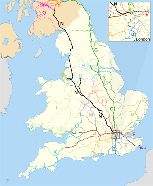
Image: Map of Network Rail Strategic Routes in England and Wales 2014

Description: Map of England and Wales showing en:Network Rail's strategic routes as of 2014. The background map shows the European regions of England and Wales. Equirectangular map projection on WGS 84 datum, with N/S stretched 170%. The thicker lines are Network Rail's primary routes.
Title: Map of Network Rail Strategic Routes in England and Wales 2014
Credit: This file was derived from: England and Wales rail network 2010.svg: Greater London UK location map 2.svg:
Author: England and Wales rail network 2010.svg: Nilfanion, created using Ordnance Survey data Greater London UK location map 2.svg: Nilfanion, created using Ordnance Survey data derivative work: Dr Greg
Usage Terms: Creative Commons Attribution-Share Alike 3.0
License: CC BY-SA 3.0
License Link: https://creativecommons.org/licenses/by-sa/3.0
Attribution Required?: Yes
Image usage
The following page links to this image:
