
Image: Map of New York highlighting Capital District

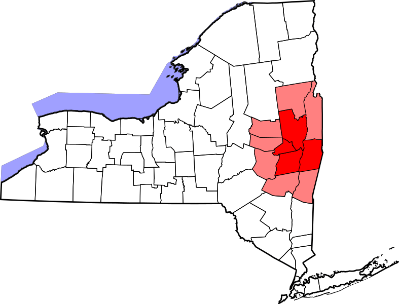
Description: Map of New York's Capital District. The Capital District is an imprecise geographical area in upstate New York centered around the state capital of Albany. Counties generally included in the Capital District are in red: Albany, Rensselaer, Saratoga, and Schenectady counties. Other counties that are sometimes included in the Capital District in part or in whole are in light red: Columbia, Greene, Montgomery, Schoharie, Fulton, Warren and Washington counties.
Title: Map of New York highlighting Capital District
Credit: Derivative work of other files, see below.
Author: Map_of_New_York_highlighting_Rensselaer_County.svg: Original uploader was David Benbennick derivative work: bamse (talk) derivative work: ZooFari
Usage Terms: Public domain
License: Public domain
Attribution Required?: No
Image usage
The following 2 pages link to this image:
