
Image: Map of Oriental India and Meridional India
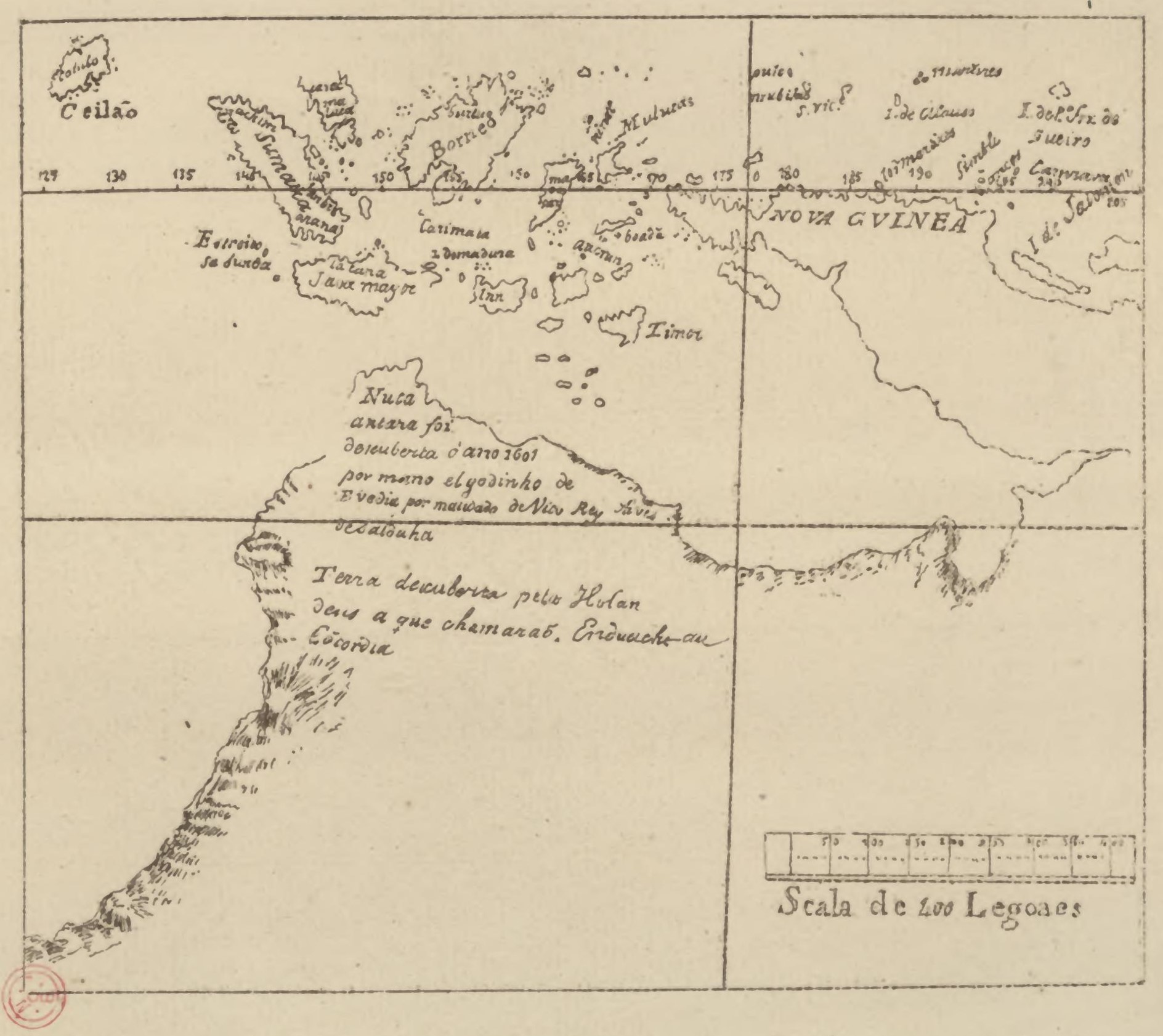
Description: Map of East India and Southern India. Showing the Nuca antara (also known as Nusantara, Lucaantara, or Luca antara) as the peninsular region of Australia. At the most northerly point, south of Java mayor , there is a legend Nuca antara foi discuberta o ano 1601 por mano el godinho de Evedia por mandado de Vico Rey Alnes de Saldaha; Nuca Antara was discovered in the year 1601 by Manoel Godinho de Eredia, by command of the Viceroy Ayres de Saldanha Beneath this, about half way down the western coast, there is another legend Terra discuberta pelos Holandeses a que chamarao, Enduacht, au cocordia; “Land discovered by the Dutch, which they called Endracht or Concord.
Title: Map of Oriental India and Meridional India
Credit: https://archive.org/details/malacca-l-inde-orientale-et-le-cathay/page/n179/mode/2up
Author: Manuel Godinho de Erédia (1563–1623)
Usage Terms: Public domain
License: Public domain
Attribution Required?: No
Image usage
The following page links to this image:
