
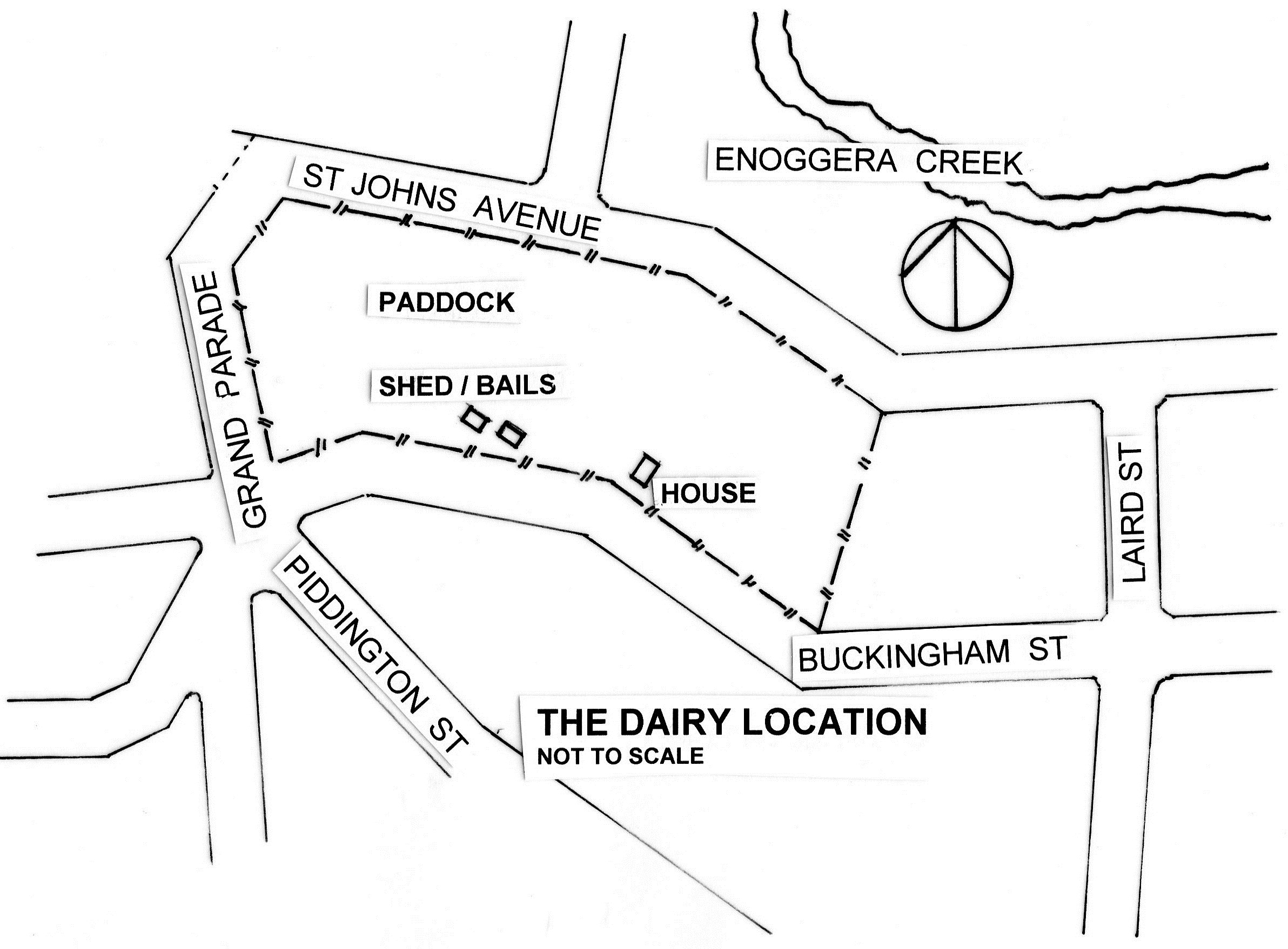
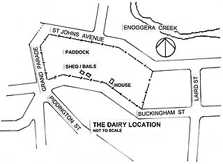
Image: Map of Peake's Dairy Farm at St Johns Wood, Ashgrove
Size of this preview: 800 × 590 pixels. Other resolutions: 320 × 236 pixels | 2,384 × 1,758 pixels.
Original image (2,384 × 1,758 pixels, file size: 457 KB, MIME type: image/jpeg)
Description: This map shows the location of the dairy farm in the mid 1930s
Title: Map of Peake's Dairy Farm at St Johns Wood, Ashgrove
Credit: Own work
Author: Jandm
Usage Terms: Creative Commons Attribution-Share Alike 3.0
License: CC BY-SA 3.0
License Link: http://creativecommons.org/licenses/by-sa/3.0
Attribution Required?: Yes
Image usage
The following page links to this image:

All content from Kiddle encyclopedia articles (including the article images and facts) can be freely used under Attribution-ShareAlike license, unless stated otherwise.