
Image: Map of Rome and Adairsville 1864
No higher resolution available.
Map_of_Rome_and_Adairsville_1864.png (466 × 528 pixels, file size: 219 KB, MIME type: image/png)
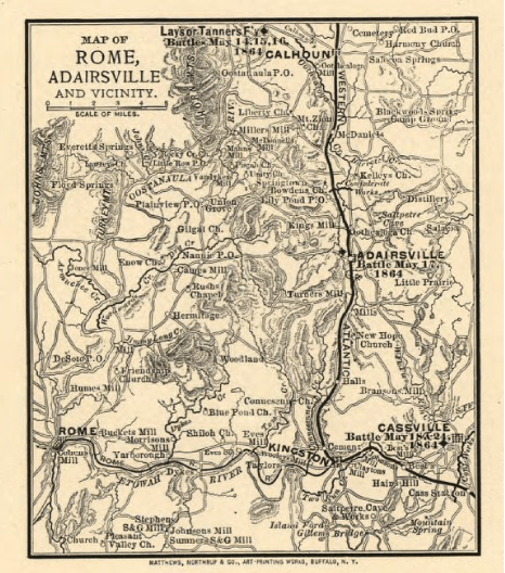
Description: Map from 1864 shows the Western and Atlantic Railroad as well as part of northern Georgia, including Calhoun, Adairsville, Rome, Kingston, and Cassville.
Title: Map of Rome and Adairsville 1864
Credit: https://www.loc.gov/item/99447298/
Author: Library of Congress, Geography and Map Division. "Map of Rome, Adairsville and vicinity". Published: Buffalo, N.Y., Matthews, Northrup & Co., Art-Printing Works, 1864.
Usage Terms: Public domain
License: Public domain
Attribution Required?: No
Image usage
The following page links to this image:

All content from Kiddle encyclopedia articles (including the article images and facts) can be freely used under Attribution-ShareAlike license, unless stated otherwise.