
Image: Map of Sicily under the Deinomenids (485-465 BC)

Size of this preview: 800 × 542 pixels. Other resolutions: 320 × 217 pixels | 1,252 × 848 pixels.
Original image (1,252 × 848 pixels, file size: 342 KB, MIME type: image/png)
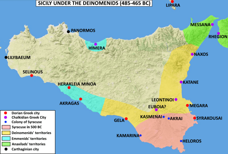
Description: Map of Sicily under the Deinomenids tyrants (485-465 BC). It shows the core territory of Syracuse (in red), and the other Greek cities controlled by the tyrants of Syracuse (in yellow). The cities controlled by Anaxilas of Rhegion are in Green, and those of Theron (of the Emmenid family) in light blue.
Title: Map of Sicily under the Deinomenids (485-465 BC)
Credit: Own work
Author: T8612
Usage Terms: Creative Commons Attribution-Share Alike 4.0
License: CC BY-SA 4.0
License Link: https://creativecommons.org/licenses/by-sa/4.0
Attribution Required?: Yes
Image usage
The following 2 pages link to this image:

All content from Kiddle encyclopedia articles (including the article images and facts) can be freely used under Attribution-ShareAlike license, unless stated otherwise.
.png)