
Image: Map of South Texas showing information about the Plan of San Diego, 1915

Size of this preview: 520 × 600 pixels. Other resolutions: 208 × 240 pixels | 1,249 × 1,440 pixels.
Original image (1,249 × 1,440 pixels, file size: 580 KB, MIME type: image/jpeg)
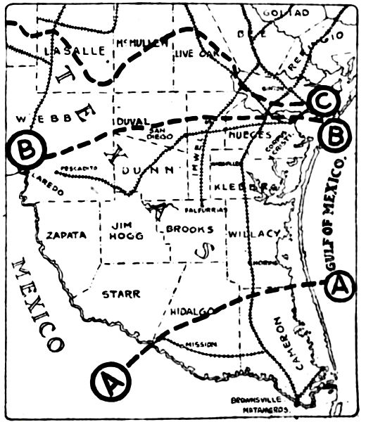
Description: South of A is the district most wrought-up at this time (November 1915). It is the southernmost part of the United States. South of B is the scene of the de la Rosa and Pizano bandit operations. South of C is what is included in the Plan of San Diego. (Caption edited and modified from the original.)
Title: Map of South Texas showing information about the Plan of San Diego, 1915
Credit: Original publication: St. Louis Post-Dispatch, November 7, 1915 Immediate source: https://www.newspapers.com/image/138984916/
Author: St. Louis Post-Dispatch (work for hire) (Life time: Not applicable.)
Usage Terms: Public domain in the United States
License: Public domain
Attribution Required?: No
Image usage
The following page links to this image:

All content from Kiddle encyclopedia articles (including the article images and facts) can be freely used under Attribution-ShareAlike license, unless stated otherwise.