
Image: Map of Ukraine border with Russia de-facto
Size of this preview: 800 × 537 pixels. Other resolutions: 320 × 215 pixels | 1,546 × 1,038 pixels.
Original image (1,546 × 1,038 pixels, file size: 59 KB, MIME type: image/png)
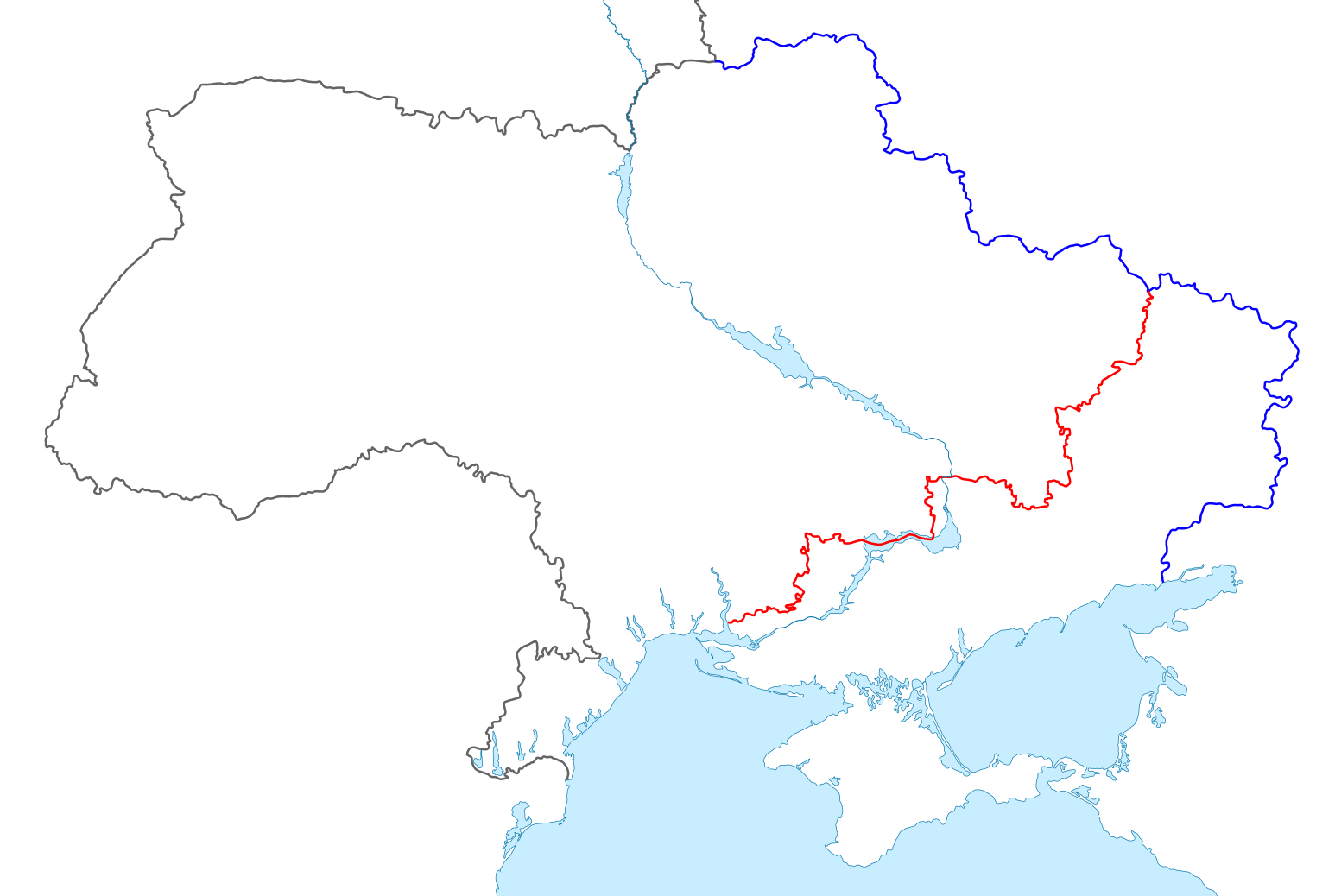
Description: Section of the state Border of Ukraine that borders Russian Federation. Blue line = 2003 bilateral border agreement. Red line = border as claimed by Russia after 2022 unilateral annexation.
Title: Map of Ukraine border with Russia de-facto
Credit: Own work
Author: DA HK
Usage Terms: Creative Commons Zero, Public Domain Dedication
License: CC0
License Link: http://creativecommons.org/publicdomain/zero/1.0/deed.en
Attribution Required?: No
Image usage
The following page links to this image:

All content from Kiddle encyclopedia articles (including the article images and facts) can be freely used under Attribution-ShareAlike license, unless stated otherwise.