
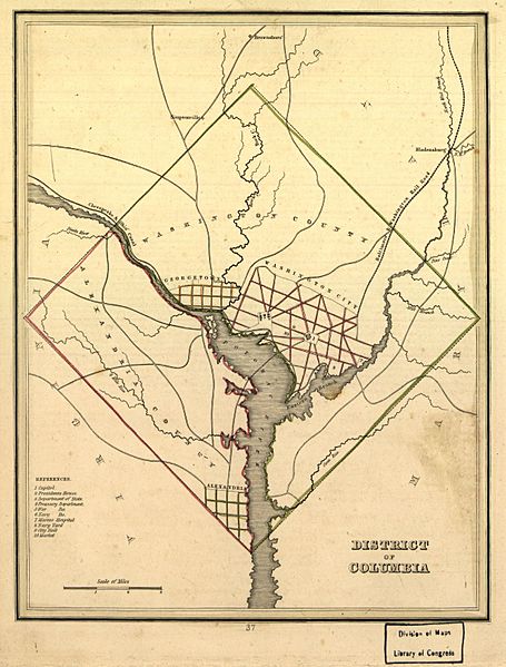
Image: Map of Washington and Alexandria County in 1835

Size of this preview: 455 × 599 pixels. Other resolutions: 182 × 240 pixels | 1,225 × 1,612 pixels.
Original image (1,225 × 1,612 pixels, file size: 310 KB, MIME type: image/jpeg)
Description: This map shows the 5 jurisdictions within the District of Columbia in 1835, prior to retrocession
Title: Map of Washington and Alexandria County in 1835
Credit: Library of Congress
Author: Unknown authorUnknown author
Usage Terms: Public domain
License: Public domain
Attribution Required?: No
Image usage
The following 2 pages link to this image:

All content from Kiddle encyclopedia articles (including the article images and facts) can be freely used under Attribution-ShareAlike license, unless stated otherwise.