
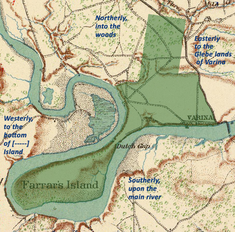
Image: Map of William Farrar's Patent for Farrar's Island and Environs
Description: This map depicts the land acquired by William Farrar as described in the 1637 Patent. The map is based on the description of the land's boundaries as described in the Patent. The area abuts the glebe lands of Varina and includes both Farrar's Island and Henrico. Patent boundaries taken from Bannister 1996,Mapping 17th Century Patents on the north side of James River, between Varina and World's End in Henrico. Map was created from Plate LXXVII map of the 1864 Bermuda Hundred Campaign from the War of the Rebellion Atlas. Military dispositions and most place names were removed, and descriptions of boundaries from patent were added.
Title: Map of William Farrar's Patent for Farrar's Island and Environs
Credit: Own work
Author: Wtfiv
Usage Terms: Creative Commons Attribution-Share Alike 4.0
License: CC BY-SA 4.0
License Link: https://creativecommons.org/licenses/by-sa/4.0
Attribution Required?: Yes
Image usage
The following page links to this image:
