
Image: Map of Woolwich, 1740s (cropped)
Size of this preview: 800 × 569 pixels. Other resolutions: 320 × 228 pixels | 1,009 × 718 pixels.
Original image (1,009 × 718 pixels, file size: 631 KB, MIME type: image/jpeg)
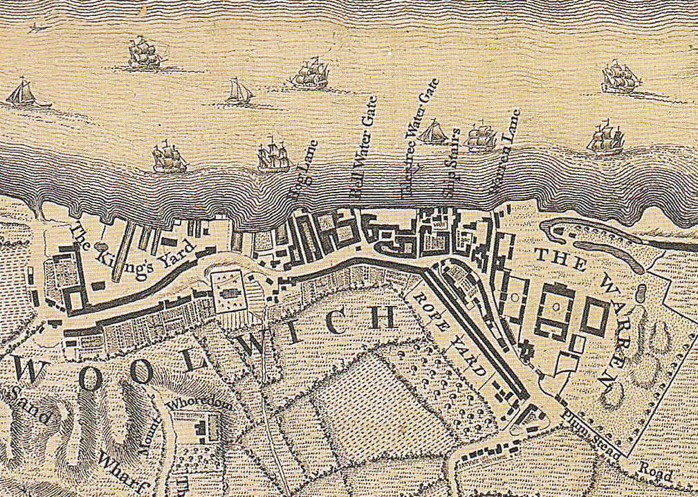
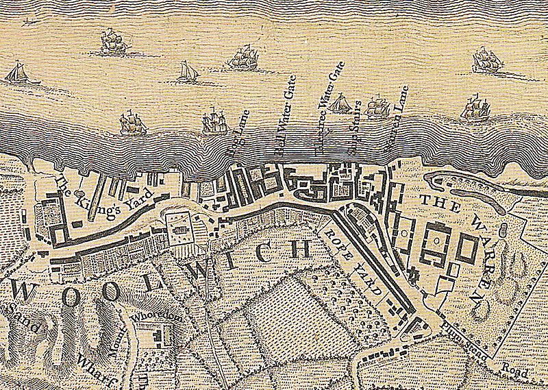
Description: Woolwich in the 1740s. Detail of a map of London in the 18th c. Engraved by Richard Parr, surveyed and published by John Rocque, 1746.
Title: Map of Woolwich, 1740s (cropped)
Credit: .mw-parser-output .smallcaps{font-variant:small-caps} Saint, A., Guillery, P. (ed.), Woolwich – Survey of London, Volume 48, p. 11. Yale Books, London, 2012. ISBN 978 0 300 18722 9
Author: John Rocque (c. 1709–1762)
Usage Terms: Public domain
License: Public domain
Attribution Required?: No
Image usage
The following 2 pages link to this image:

All content from Kiddle encyclopedia articles (including the article images and facts) can be freely used under Attribution-ShareAlike license, unless stated otherwise.
.jpg)