
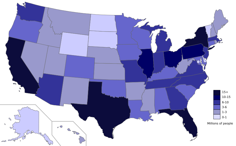
Image: Map of each state's population as of 2013

Size of this PNG preview of this SVG file: 800 × 495 pixels. Other resolution: 320 × 198 pixels.
Original image (SVG file, nominally 959 × 593 pixels, file size: 49 KB)
Description: The population of the States as of July 2013, based on data from United States Census Bureau.
Title: Map of each state's population as of 2013
Credit: Own work; Map is based on here.
Author: Ali Zifan
Usage Terms: Creative Commons Zero, Public Domain Dedication
License: CC0
License Link: http://creativecommons.org/publicdomain/zero/1.0/deed.en
Attribution Required?: No
Image usage
There are no pages that link to this image.

All content from Kiddle encyclopedia articles (including the article images and facts) can be freely used under Attribution-ShareAlike license, unless stated otherwise.