
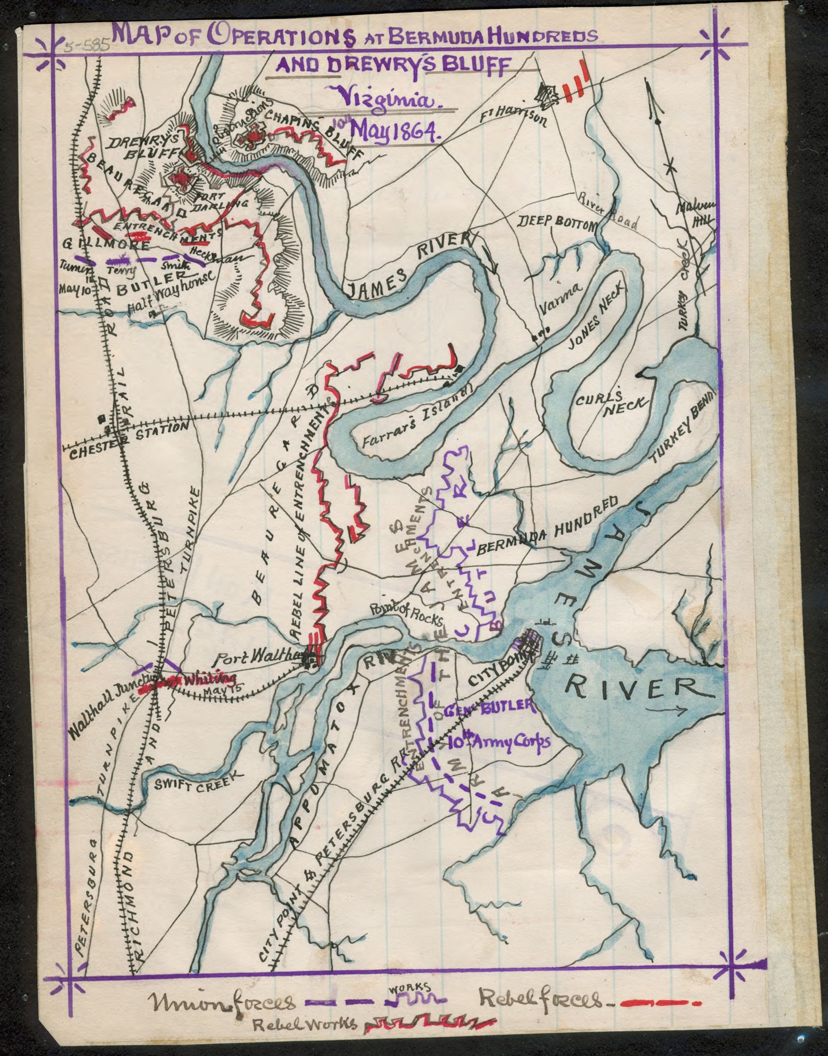
Image: Map of operations at Bermuda Hundred and Drewry's Bluff, Virginia, 10th May 1864. LOC gvhs01.vhs00178
Description: In this map Sneden attempts to show several engagements that took place between Butler's Army of the James and Beauregard's Confederates, May 6th through May 13th, 1864. He includes Port Walthall Junction, where Union forces first engaged Beauregard's Confederates; the Confederate defense of Fort Darling at Drewry's Bluff; and the Union entrenchments astride the Appomattox River at Bermuda Hundred and City Point, where they were blocked by Confederate forces spanning the peninsula formed by the Appomattox and James rivers.
Title: Map of operations at Bermuda Hundred and Drewry's Bluff, Virginia, 10th May 1864. LOC gvhs01.vhs00178
Credit: https://www.loc.gov/item/gvhs01.vhs00178/
Author: Sneden, Robert Knox
Permission: This map is available from the United States Library of Congress's Geography & Map Division under the digital ID gvhs01.vhs00178. This tag does not indicate the copyright status of the attached work. A normal copyright tag is still required. See Commons:Licensing for more information.
Usage Terms: Public domain
License: Public domain
Attribution Required?: No
Image usage
The following page links to this image:
