
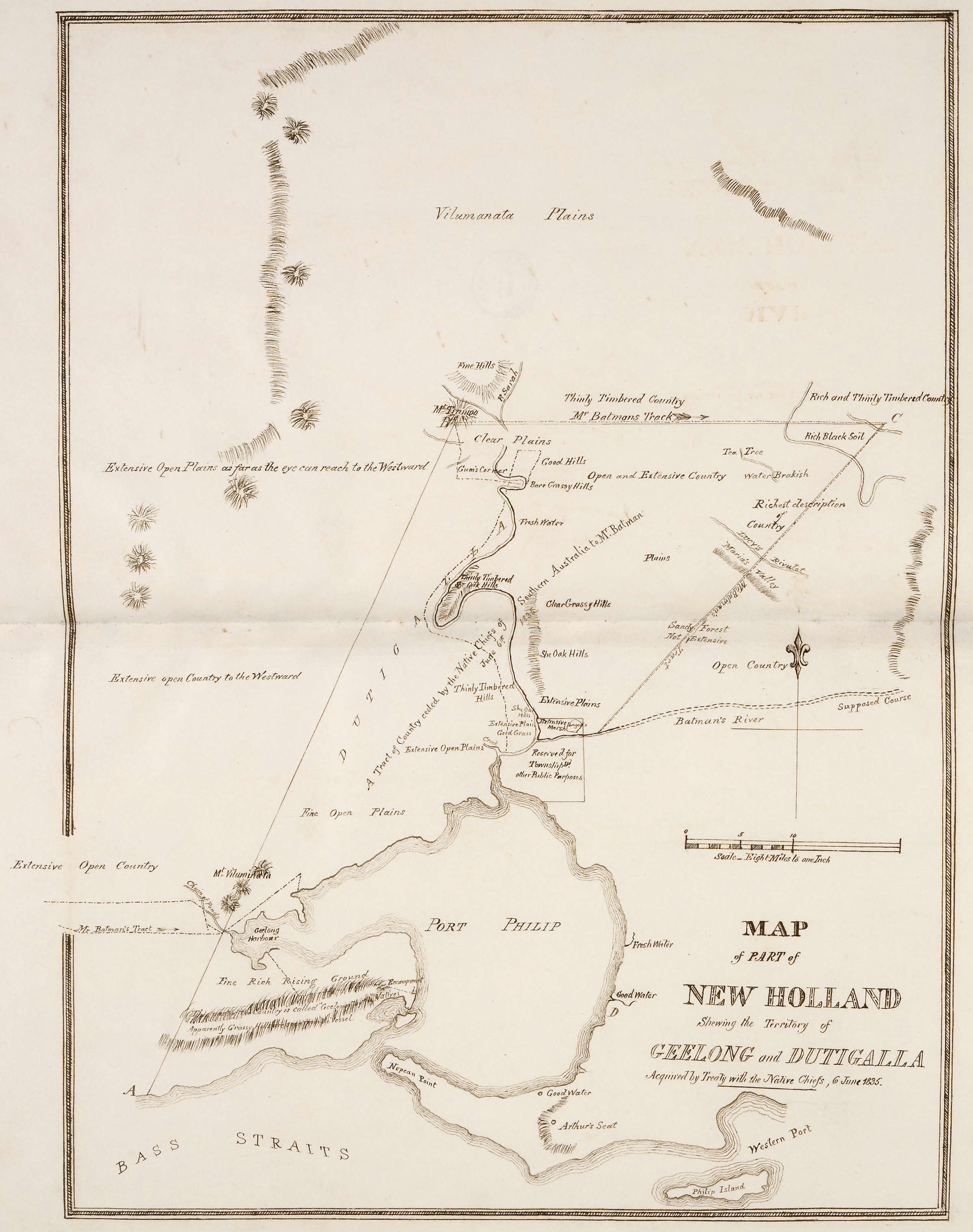
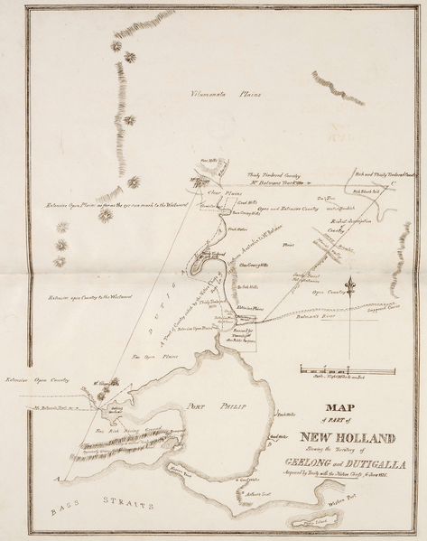
Image: Map of part of New Holland showing the territory of Geelong and Dutigalla
Size of this preview: 473 × 599 pixels. Other resolutions: 189 × 240 pixels | 2,396 × 3,033 pixels.
Original image (2,396 × 3,033 pixels, file size: 5.32 MB, MIME type: image/png)
Description: This is a map of the area which is now Melbourne and the Port Philip Bay in Australia, including the northerly Hinterland. The original map caption reads "MAP of PART of NEW HOLLAND Showing the Territory of GEELONG and DUTIGALLA Acquired by Treaty with the Native Chiefs, 6 June 1835." Scale: "Eight Miles to one Inch".
Usage Terms: Public domain
Image usage
The following page links to this image:

All content from Kiddle encyclopedia articles (including the article images and facts) can be freely used under Attribution-ShareAlike license, unless stated otherwise.