
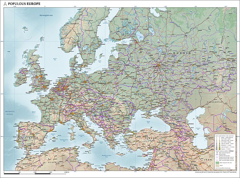
Image: Map of populous Europe (physical, political, population) with legend

Size of this preview: 800 × 596 pixels. Other resolutions: 320 × 239 pixels | 3,720 × 2,773 pixels.
Original image (3,720 × 2,773 pixels, file size: 3.76 MB, MIME type: image/jpeg)
Description: Map of the most populous part of Europe, showing physical, political and population characteristics, in Mercator projection, with legend, as per 2018. Compiled using QGIS and CC-0 Natural Earth geodata.
Title: Map of populous Europe (physical, political, population) with legend
Credit: Own work
Author: Janwillemvanaalst
Usage Terms: Creative Commons Attribution 4.0
License: CC BY 4.0
License Link: https://creativecommons.org/licenses/by/4.0
Attribution Required?: Yes
Image usage
The following page links to this image:

All content from Kiddle encyclopedia articles (including the article images and facts) can be freely used under Attribution-ShareAlike license, unless stated otherwise.
_with_legend.jpg)