
Image: Map of reading abbey 2
Size of this preview: 742 × 599 pixels. Other resolutions: 297 × 240 pixels | 2,528 × 2,042 pixels.
Original image (2,528 × 2,042 pixels, file size: 84 KB, MIME type: image/png)
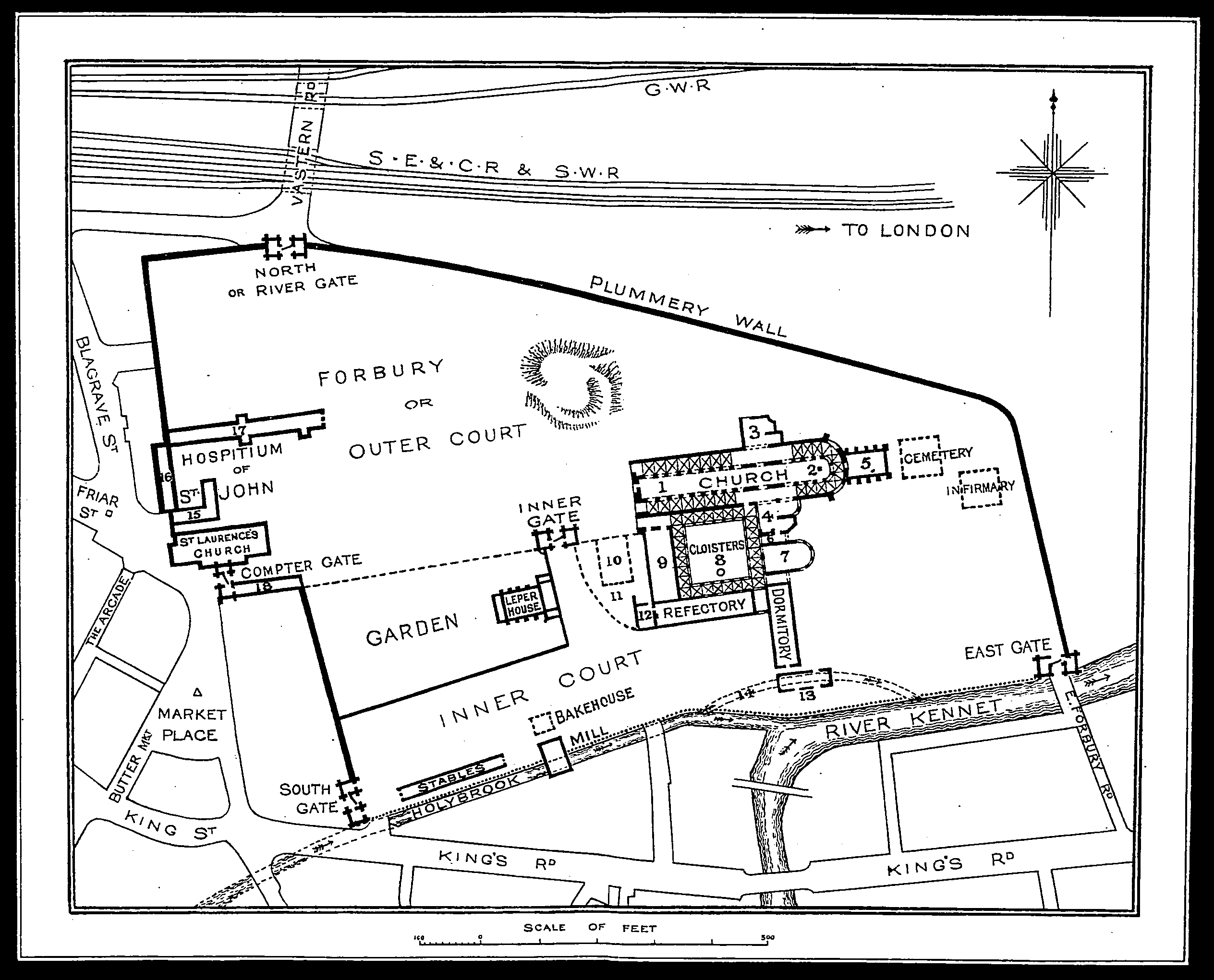
Description: Jamieson B. Hurry's map of Reading Abbey as it would have existed before it demolishing.
Title: Map of reading abbey 2
Credit: Hurry, Jamieson B. (1906) The Rise and Fall of Reading Abbey[1], London: Elliot Stock, pages 86-7
Author: Jamieson B. Hurry (1857-1930)
Usage Terms: Public domain
License: Public domain
Attribution Required?: No
Image usage
The following page links to this image:

All content from Kiddle encyclopedia articles (including the article images and facts) can be freely used under Attribution-ShareAlike license, unless stated otherwise.