
Image: Map of the Auckland urban area, 2009, cropped

Size of this preview: 479 × 599 pixels. Other resolutions: 192 × 240 pixels | 3,932 × 4,917 pixels.
Original image (3,932 × 4,917 pixels, file size: 1.01 MB, MIME type: image/jpeg)
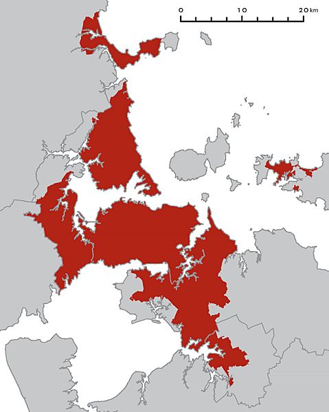
Description: A map of the Auckland region with the Auckland urban area highlighted in red. The existing region and district boundaries are shown with grey lines; these are no longer current. North is at the top. The coastline shown around Puketutu Island, east of Mangere, is inaccurate. It shows all the area between the island and the mainland (formerly occupied by sewage treatment ponds) as land.
Title: Map of the Auckland urban area, 2009, cropped
Credit: Map_of_the_Auckland_urban_area,_2009.jpg
Author: Map_of_the_Auckland_urban_area,_2009.jpg: Royal Commission on Auckland Governance derivative work: Avenue (talk)
Usage Terms: Public domain
License: Public domain
Attribution Required?: No
Image usage
There are no pages that link to this image.

All content from Kiddle encyclopedia articles (including the article images and facts) can be freely used under Attribution-ShareAlike license, unless stated otherwise.