
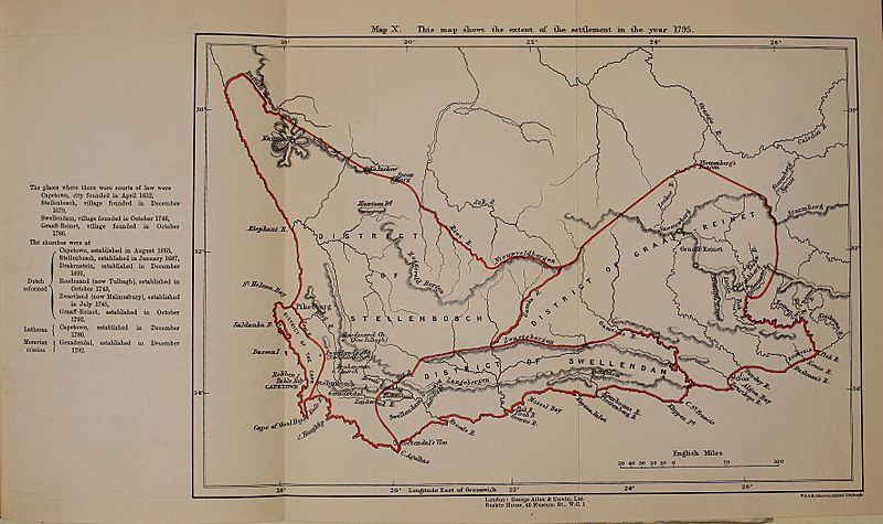
Image: Map of the Dutch Cape Colony in 1795

Size of this preview: 800 × 475 pixels. Other resolutions: 320 × 190 pixels | 3,546 × 2,107 pixels.
Original image (3,546 × 2,107 pixels, file size: 763 KB, MIME type: image/jpeg)
Description: Map of the Dutch Cape Colony in 1795, from page 374 of "History of Africa south of the Zambesi - from the settlement of the Portuguese at Sofala in September 1505 to the conquest of the Cape Colony by the British in September 1795" (1916)
Title: Map of the Dutch Cape Colony in 1795
Credit: https://archive.org/stream/historyofafricas03thea/historyofafricas03thea#page/n374/mode/1up
Author: George McCall Theal
Usage Terms: Public domain
License: Public domain
Attribution Required?: No
Image usage
The following page links to this image:

All content from Kiddle encyclopedia articles (including the article images and facts) can be freely used under Attribution-ShareAlike license, unless stated otherwise.