
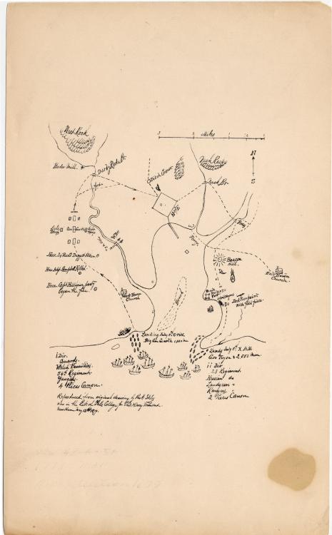
Image: Map of the English invasion of New Haven Connecticut July 1779
Size of this preview: 372 × 600 pixels. Other resolutions: 149 × 240 pixels | 465 × 750 pixels.
Original image (465 × 750 pixels, file size: 35 KB, MIME type: image/jpeg)
Description: Map of the British invasion of New Haven, Connecticut, in July 1779. Drawing by Ezra Stiles. Image courtesy of the Yale University Manuscripts & Archives Digital Images Database, Yale University, New Haven, Connecticut.
Title: Map of the English invasion of New Haven Connecticut July 1779
Credit: Yale University Manuscripts & Archives Digital Images Database [1]
Author: Ezra Stiles
Usage Terms: Public domain
License: Public domain
Attribution Required?: No
Image usage
The following page links to this image:

All content from Kiddle encyclopedia articles (including the article images and facts) can be freely used under Attribution-ShareAlike license, unless stated otherwise.