
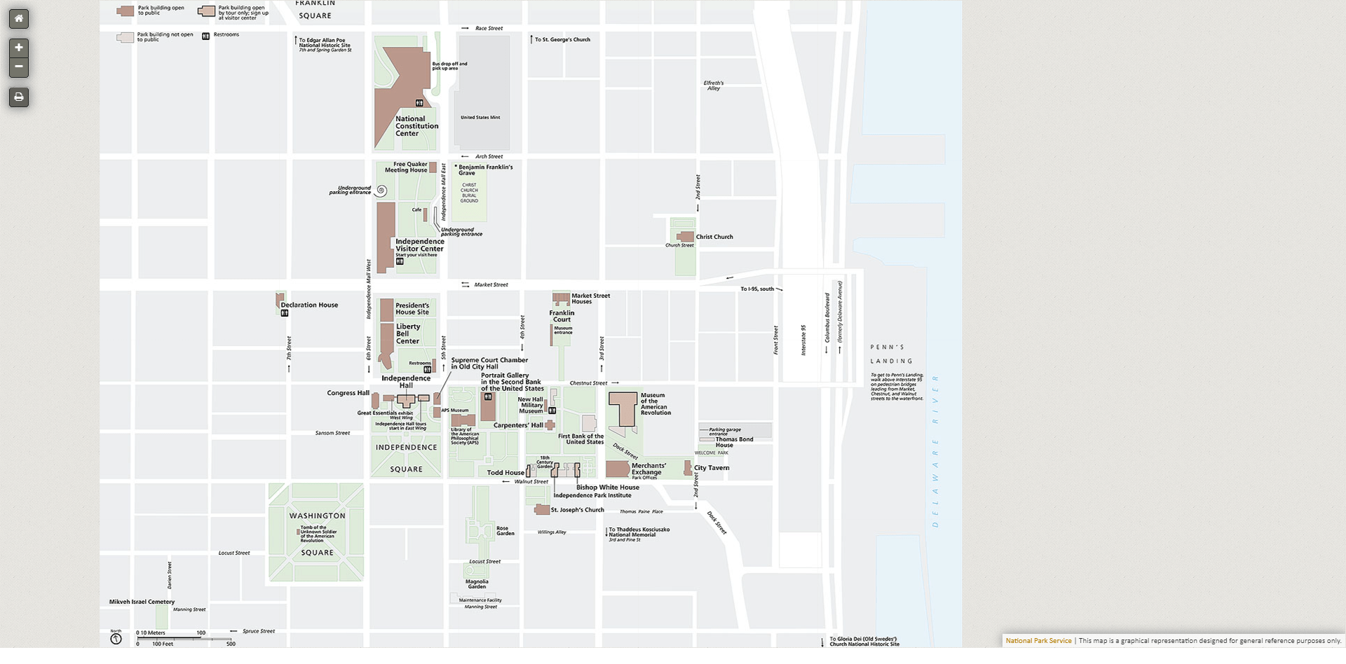
Image: Map of the Independence National Historic Park (as of 2024-01-23)
Size of this preview: 800 × 395 pixels. Other resolutions: 320 × 158 pixels | 1,920 × 948 pixels.
Original image (1,920 × 948 pixels, file size: 338 KB, MIME type: image/png)
Description: Map of the Independence National Historic Park (as of 2024-01-23)
Title: Map of the Independence National Historic Park (as of 2024-01-23)
Credit: https://www.nps.gov/inde/planyourvisit/maps.htm
Usage Terms: Public domain
License: Public domain
Attribution Required?: No
Image usage
The following page links to this image:

All content from Kiddle encyclopedia articles (including the article images and facts) can be freely used under Attribution-ShareAlike license, unless stated otherwise.
.png)