
Image: Map of the Lý dynasty
Size of this preview: 487 × 599 pixels. Other resolutions: 195 × 240 pixels | 650 × 800 pixels.
Original image (650 × 800 pixels, file size: 50 KB, MIME type: image/png)
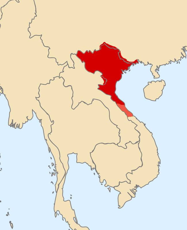
Description: The northern boundary of Dai Viet during the Ly dynasty included present-day North Vietnam and a small part of Guangxi province (China). During the southern period of the Ly Dynasty when it was established, it only reached the present Ha Tinh area. In 1069, Ly Thanh Tong attacked Champa, forcing Champa king Che Cu to offer 3 continents equivalent to present-day Quang Binh and Quang Tri provinces. This area was maintained stably until the end of the Ly dynasty.
Title: Map of the Lý dynasty
Credit: Own work
Author: TRMC
Usage Terms: Creative Commons Attribution-Share Alike 4.0
License: CC BY-SA 4.0
License Link: https://creativecommons.org/licenses/by-sa/4.0
Attribution Required?: Yes
Image usage
The following page links to this image:

All content from Kiddle encyclopedia articles (including the article images and facts) can be freely used under Attribution-ShareAlike license, unless stated otherwise.