
Image: Map of the New Discoveries in the Eastern Ocean WDL126
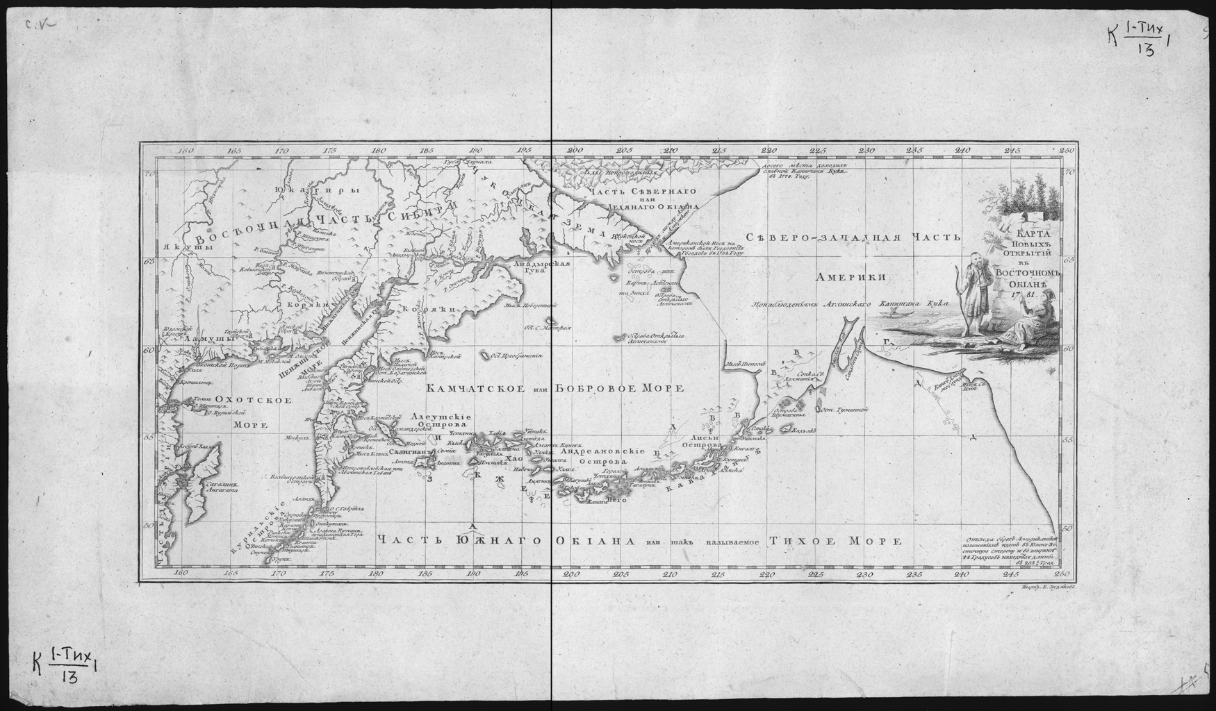
Description: This Russian map of 1781 depicts parts of eastern Siberia and the northwestern part of the North American continent, including places reached by the Russians Mikhail Gvozdev and Ivan Sind, the English explorer Captain James Cook, and others. In 1732, the expedition led by Gvozdev and the navigator Ivan Fedorov crossed the Bering Strait between Asia and America, discovered the Diomede Islands, and approached Alaska in the vicinity of Cape Prince of Wales. The expedition landed on the shore of the North American mainland, marked on the map as the “American Point,” and reported that what they discovered was not an island but a far greater landmass. South of the Bering Strait, the map shows the islands mapped by Lieutenant Sind in 1764-68 and several islands discovered by the English. Northeast of Bering Strait, in the far north of present-day Alaska, is a point reached by Cook in 1778 during his third voyage to the Pacific in his quest for the elusive Northwest Passage. It is marked on the map with the words: “Glorious Captain Cook reached this place in 1778.” The map also points out areas inhabited by various ethnic groups with whom the Russian and European explorers made early contacts: Yakut, Koryak, Yukagir, and others.
Title: Map of the New Discoveries in the Eastern Ocean
Credit: http://dl.wdl.org/126.png Gallery: http://www.wdl.org/en/item/126/
Usage Terms: Public domain
License: Public domain
Attribution Required?: No
Image usage
The following page links to this image:
