
Image: Map of the Periplus of the Erythraean Sea
Size of this preview: 800 × 438 pixels. Other resolutions: 320 × 175 pixels | 3,507 × 1,921 pixels.
Original image (3,507 × 1,921 pixels, file size: 1.58 MB, MIME type: image/jpeg)
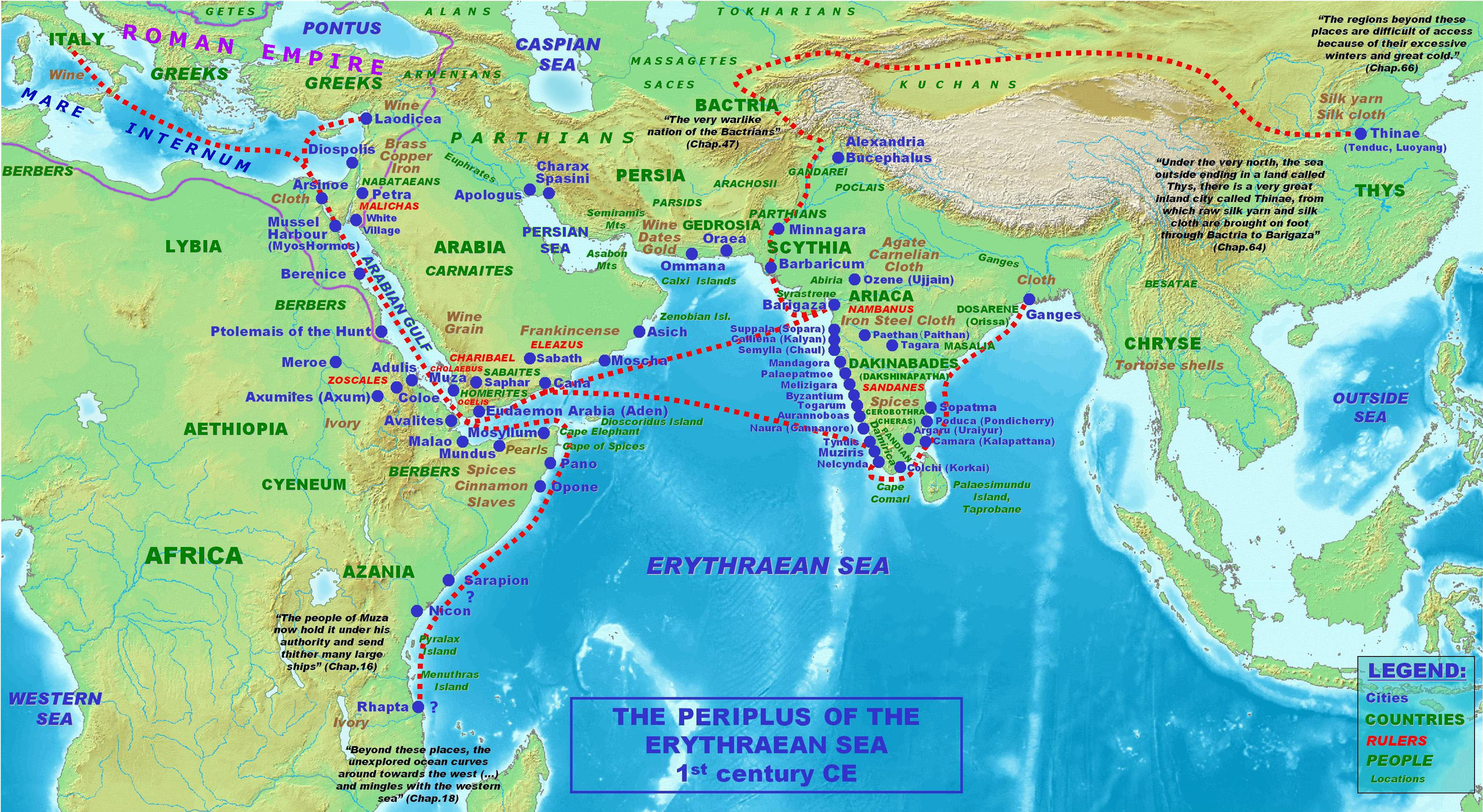
Description: Locations, names and routes of the Periplus of the Erythraean Sea (1st century CE).
Title: Map of the Periplus of the Erythraean Sea
Credit: self-made, background topographical map from Wikipedia Commons Image:Topographic30deg N0E60.png
Author: PHGCOM
Usage Terms: Creative Commons Attribution-Share Alike 4.0
License: CC BY-SA 4.0
License Link: https://creativecommons.org/licenses/by-sa/4.0
Attribution Required?: Yes
Image usage
The following page links to this image:

All content from Kiddle encyclopedia articles (including the article images and facts) can be freely used under Attribution-ShareAlike license, unless stated otherwise.