
Image: Map of the Sultanate of Sulu
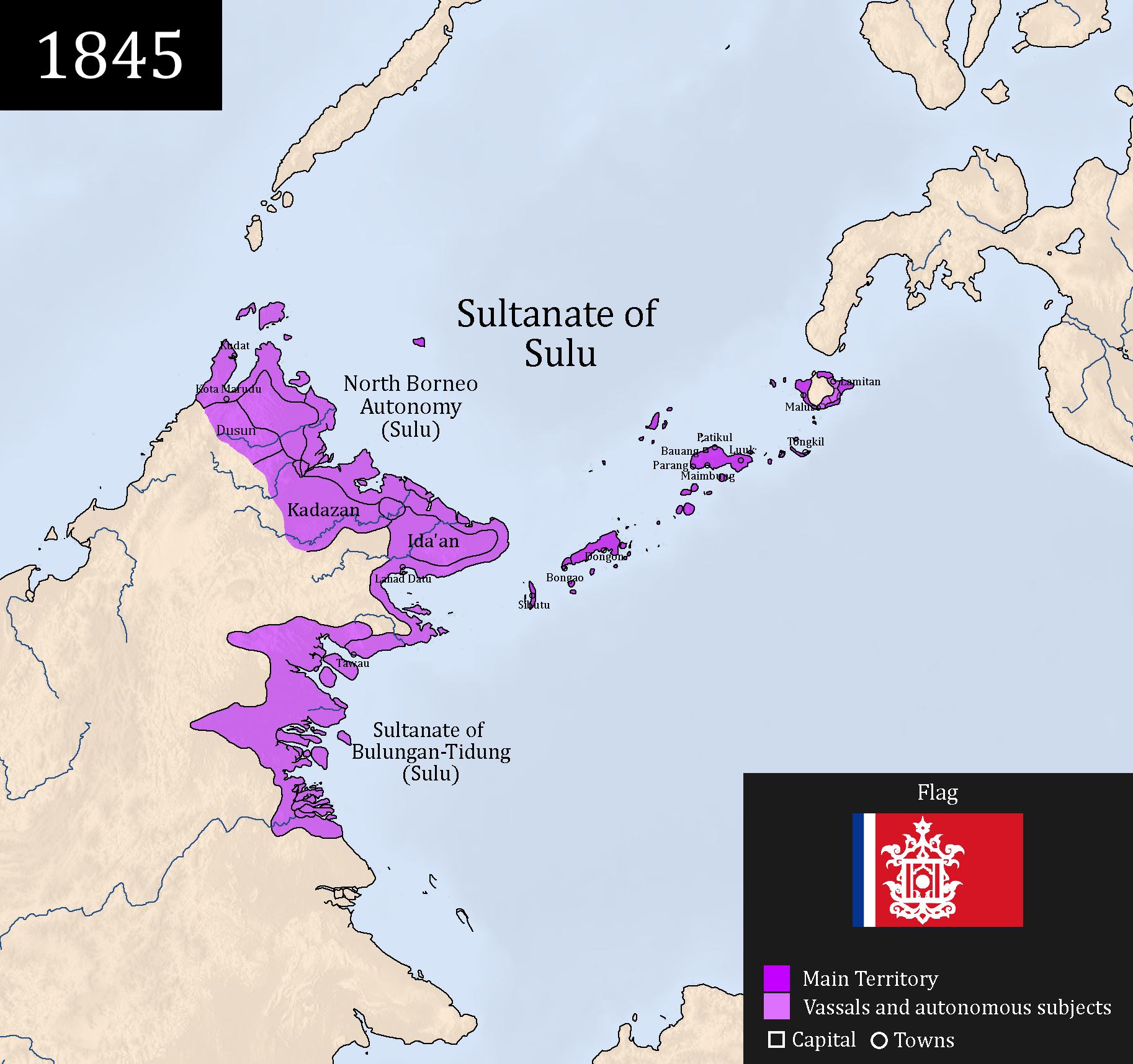
Description: A map of the maximum extent of the Sultanate of Sulu (purple) and its vassals/subjects (lighter purple) in 1845.
Title: Map of the Sultanate of Sulu
Credit: Own work in accordance to: North Borneo was under Sulu from 1704-1878. Historical Notes on the North Borneo Dispute by Leigh R. Wright, which mentioned that North Borneo had a high degree of autonomy under the suzerainty of Sulu rather than proper administration. The Sultanate of Bulungan was under the influence of Sulu ever since the fall of Kutai to the Dutch (1844) until 1878. From 1848 and so on, Bulungan was also influenced by the Dutch. Spanish-Moro conflict History of Basilan Wikipedia page for the Kedatuans in Basilan that were under the control of Sulu.
Author: Delirium333
Usage Terms: Creative Commons Attribution-Share Alike 4.0
License: CC BY-SA 4.0
License Link: https://creativecommons.org/licenses/by-sa/4.0
Attribution Required?: Yes
Image usage
The following page links to this image:
