
Image: Map of the Tarim Mummies (Tarim detail)
Size of this preview: 800 × 471 pixels. Other resolutions: 320 × 188 pixels | 2,656 × 1,564 pixels.
Original image (2,656 × 1,564 pixels, file size: 3.91 MB, MIME type: image/png)
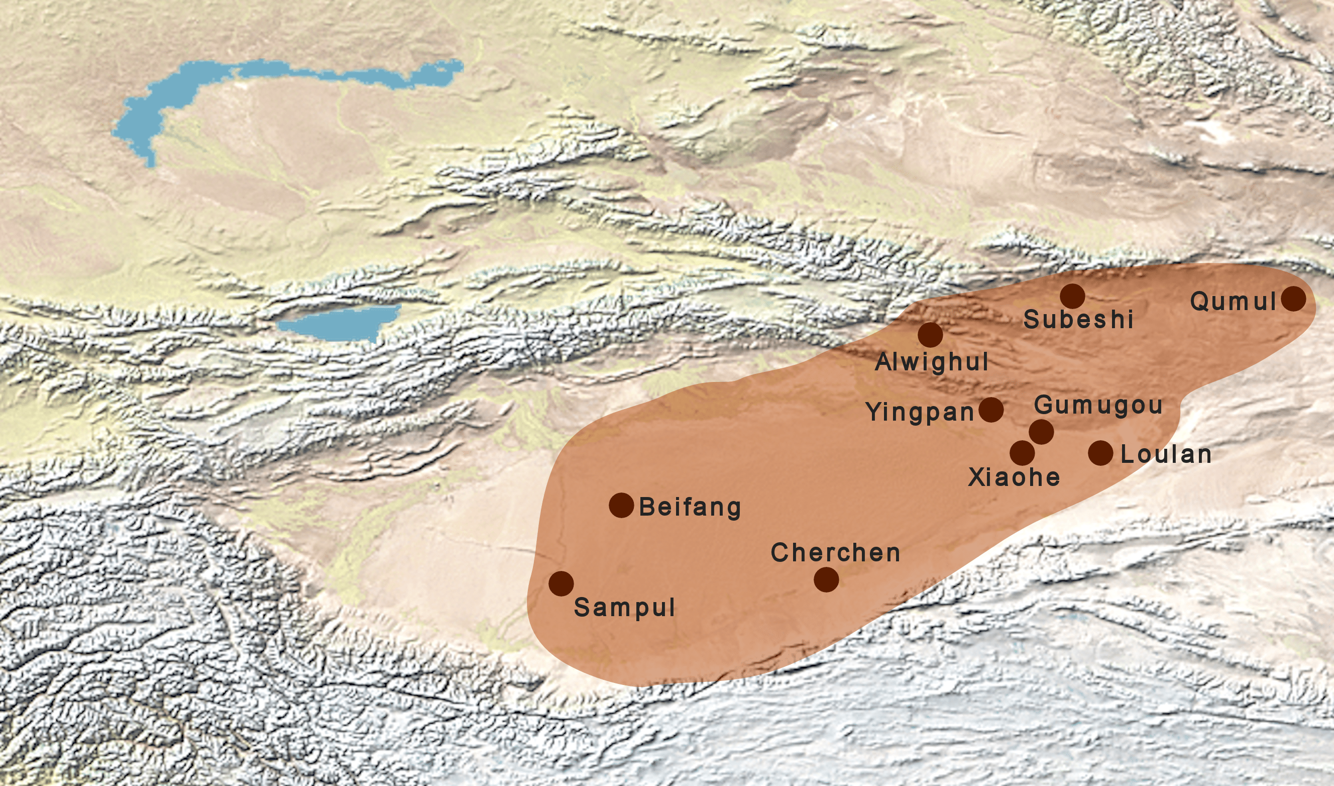
Description: Map of the Tarim Mummies (Tarim detail). Including Sampul, Beifang, Cherchen, Xiaohe, Loulan, Gumugou, Yingpan, Alwighul, Subeshi, Qumul. Extended area per northern Xiahe culture route map Fig. 3
Title: Map of the Tarim Mummies (Tarim detail)
Credit: This file has been extracted from another file
Author: naturalearthdata.com, offered to the Public Domain per Terms of Use
Usage Terms: Creative Commons Attribution-Share Alike 4.0
License: CC BY-SA 4.0
License Link: https://creativecommons.org/licenses/by-sa/4.0
Attribution Required?: Yes
Image usage
The following page links to this image:

All content from Kiddle encyclopedia articles (including the article images and facts) can be freely used under Attribution-ShareAlike license, unless stated otherwise.
.png)