
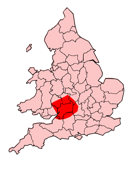
Image: Map of the Territory of the Dobunni

Size of this PNG preview of this SVG file: 424 × 600 pixels. Other resolution: 170 × 240 pixels.
Original image (SVG file, nominally 744 × 1,052 pixels, file size: 148 KB)
Description: A map showing the territory of the Dobunni tribe overlayed in red in the context of the modern county boundaries of England and wales
Title: Map of the Territory of the Dobunni
Credit: Map_of_the_Territory_of_the_Cornovii_(Midlands).svg
Author: Map_of_the_Territory_of_the_Cornovii_(Midlands).svg: *Map_of_the_Territory_of_the_Cornovii_(Midlands).png: Jpb1301 derivative work: Jpb1301 (talk) derivative work: Jpb1301 (talk)
Usage Terms: Creative Commons Attribution-Share Alike 3.0
License: CC BY-SA 3.0
License Link: https://creativecommons.org/licenses/by-sa/3.0
Attribution Required?: Yes
Image usage
The following page links to this image:

All content from Kiddle encyclopedia articles (including the article images and facts) can be freely used under Attribution-ShareAlike license, unless stated otherwise.