
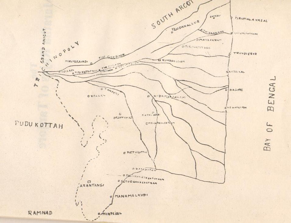
Image: Map of the Thanjavur Maratha kingdom
Size of this preview: 781 × 599 pixels. Other resolutions: 313 × 240 pixels | 955 × 733 pixels.
Original image (955 × 733 pixels, file size: 77 KB, MIME type: image/jpeg)
Description: A map of the Thanjavur Maratha kingdom . The Thanjavur Maratha kingdom roughly corresponded to the Chola Nadu region of Tamil Nadu.
Title: Map of the Thanjavur Maratha kingdom
Credit: The Maratha Rajas of Tanjore by K. R. Subramaniam, 1929
Usage Terms: Public domain
License: Public domain
Attribution Required?: No
Image usage
The following 2 pages link to this image:

All content from Kiddle encyclopedia articles (including the article images and facts) can be freely used under Attribution-ShareAlike license, unless stated otherwise.