
Image: Map of the Town and Environs of Belfast (1791)
Size of this preview: 602 × 599 pixels. Other resolutions: 241 × 240 pixels | 2,992 × 2,978 pixels.
Original image (2,992 × 2,978 pixels, file size: 11.97 MB, MIME type: image/png)
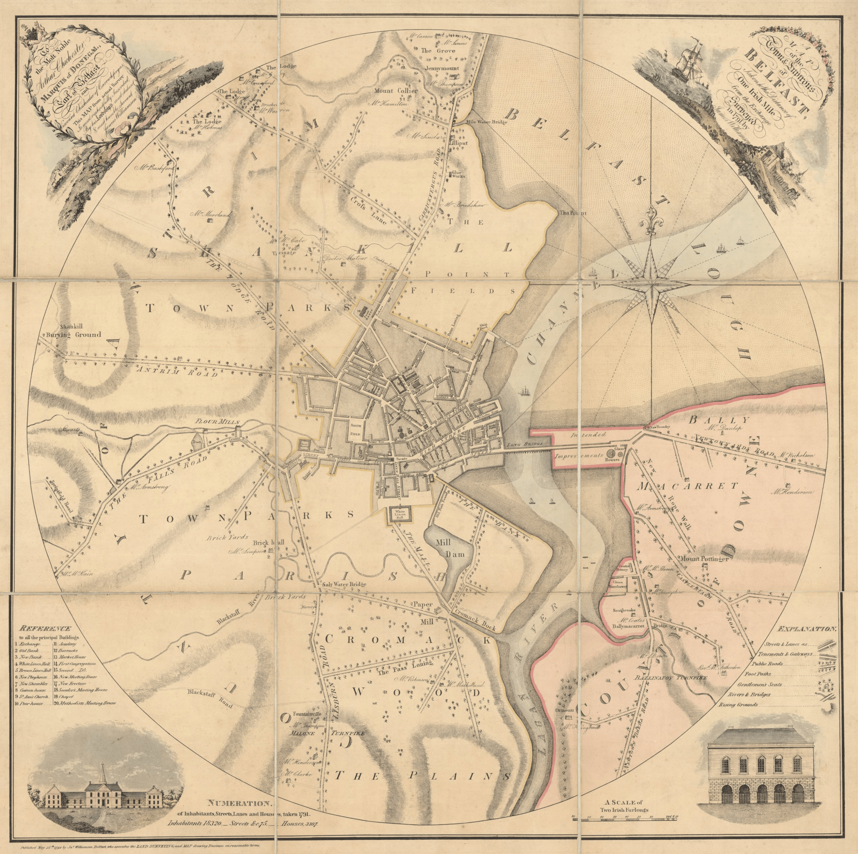
Description: "A Map of the Town and Environs of Belfast, Taken to the Distance of One Irish Mile from the Exchange: Surveyed in 1791 by James Williamson."
Title: Map of the Town and Environs of Belfast (1791)
Credit: https://nmni.com/collections/history/maps/belump61986
Author: James Williamson (1756–1832)
Usage Terms: Public domain
License: Public domain
Attribution Required?: No
Image usage
The following page links to this image:

All content from Kiddle encyclopedia articles (including the article images and facts) can be freely used under Attribution-ShareAlike license, unless stated otherwise.
.png)