
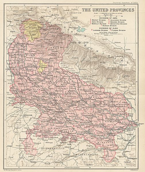
Image: Map of the United Provinces from The Imperial Gazetteer of India (1907-1909)

Size of this preview: 505 × 599 pixels. Other resolutions: 202 × 240 pixels | 1,000 × 1,186 pixels.
Original image (1,000 × 1,186 pixels, file size: 427 KB, MIME type: image/jpeg)
Description: Map of United Provinces from The Imperial Gazetteer of India Volume 24, opposite page 250. New edition, published under the authority of His Majesty's Secretary of State for India in Council. Oxford: Clarendon Press, 1907-1909. Scale: 1:6,000,000. 1 in. to 94.6 miles.
Divisions of Agra: 1. Meerut Division, 2. Agra Division, 3. Bareilly Division, 4. Allahabad Division, 5. Benares Division, 6. Gorakhpur Division, 7. Kumaun Division. Divisions of Oudh: 8. Lucknow Division, 9. Fyzabad Division.
Usage Terms: Public domain
Image usage
The following page links to this image:

All content from Kiddle encyclopedia articles (including the article images and facts) can be freely used under Attribution-ShareAlike license, unless stated otherwise.
.jpg)