
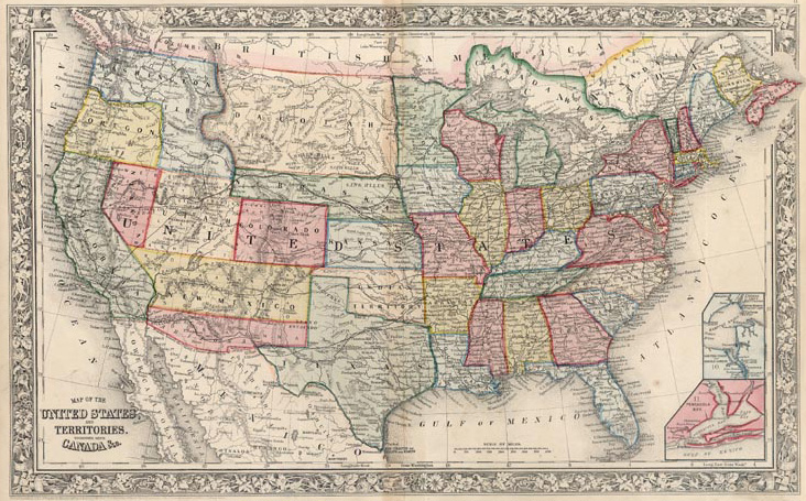
Image: Map of the United States, and Territories Together with Canada From Mitchell's New General Atlas Philadelphia SA Mitchell Jr 1861
No higher resolution available.
Map_of_the_United_States,_and_Territories_Together_with_Canada_From_Mitchell's_New_General_Atlas_Philadelphia_SA_Mitchell_Jr_1861.jpg (732 × 455 pixels, file size: 237 KB, MIME type: image/jpeg)
Description: "Map of the United States, and Territories. Together with Canada &c." From Mitchell's New General Atlas. Philadelphia: S.A. Mitchell, Jr., 1861. 13 1/2 x 21 3/4. Lithograph. Original hand color.
Title: Map of the United States, and Territories Together with Canada From Mitchell's New General Atlas Philadelphia SA Mitchell Jr 1861
Credit: http://www.philaprintshop.com/arizterr.html
Author: S.A. Mitchell, Jr.
Usage Terms: Public domain
License: Public domain
Attribution Required?: No
Image usage
The following page links to this image:

All content from Kiddle encyclopedia articles (including the article images and facts) can be freely used under Attribution-ShareAlike license, unless stated otherwise.