
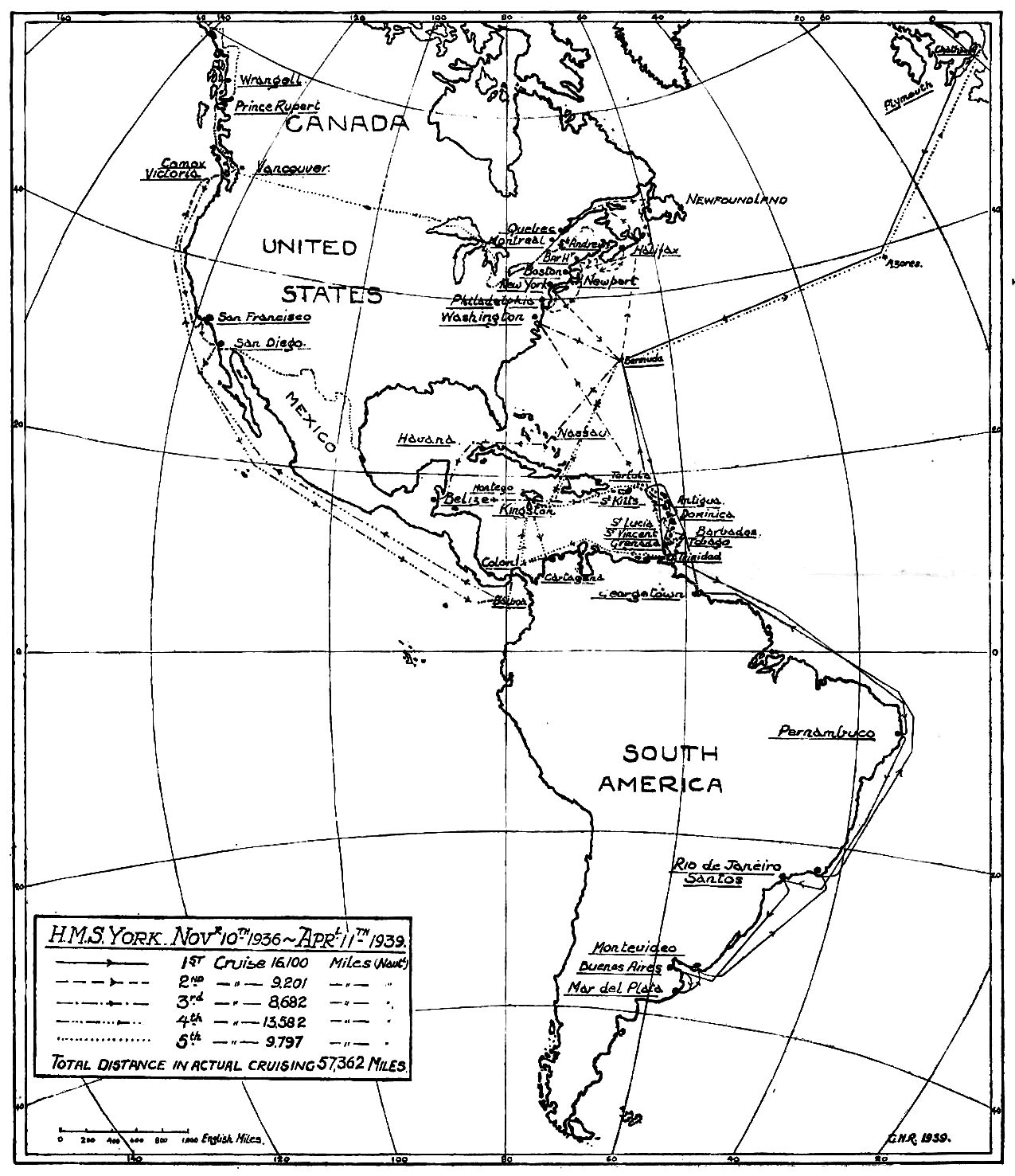
Image: Map of the cruises of the Bermuda-based HMS York on the America & West Indies Station, 1936-1939
Description: Map of the cruises of the Royal Navy heavy cruiser HMS York while on the America & West Indies Station, 1936-1939, including its initial journey to its base at the Royal Naval Dockyard on Ireland Island in the Imperial fortress colony of Bermuda, in the North Atlantic, cruises from Bermuda to various Atlantic (including the Caribbean and the Gulf of Mexico) and Pacific ports in countries and territories of North America, Central America, South America and the West Indies, and her final departure from Bermuda, and the station, to return to England to pay off at the end of the commission.
Title: Map of the cruises of the Bermuda-based HMS York on the America & West Indies Station, 1936-1939
Credit: "H.M.S. York 1936-1939", full title "In The Western Hemisphere with "H.M.S. York" 1936-1939"(account of HMS York while on the America and West Indies Station).
Author: Possible signature: GHR. Otherwise, the author of the text is anonymous (an officer of HMS York), as are the illustrators. The only officer of these initials listed on the books of HMS York in the Navy List (March, 1939; page 305) is Commissioned Gunner G. H. Read.
Usage Terms: Public domain
License: Public domain
Attribution Required?: No
Image usage
The following 2 pages link to this image:
