
Image: Map of the old Chicago Portage
Size of this preview: 800 × 479 pixels. Other resolutions: 320 × 192 pixels | 2,189 × 1,312 pixels.
Original image (2,189 × 1,312 pixels, file size: 551 KB, MIME type: image/jpeg)
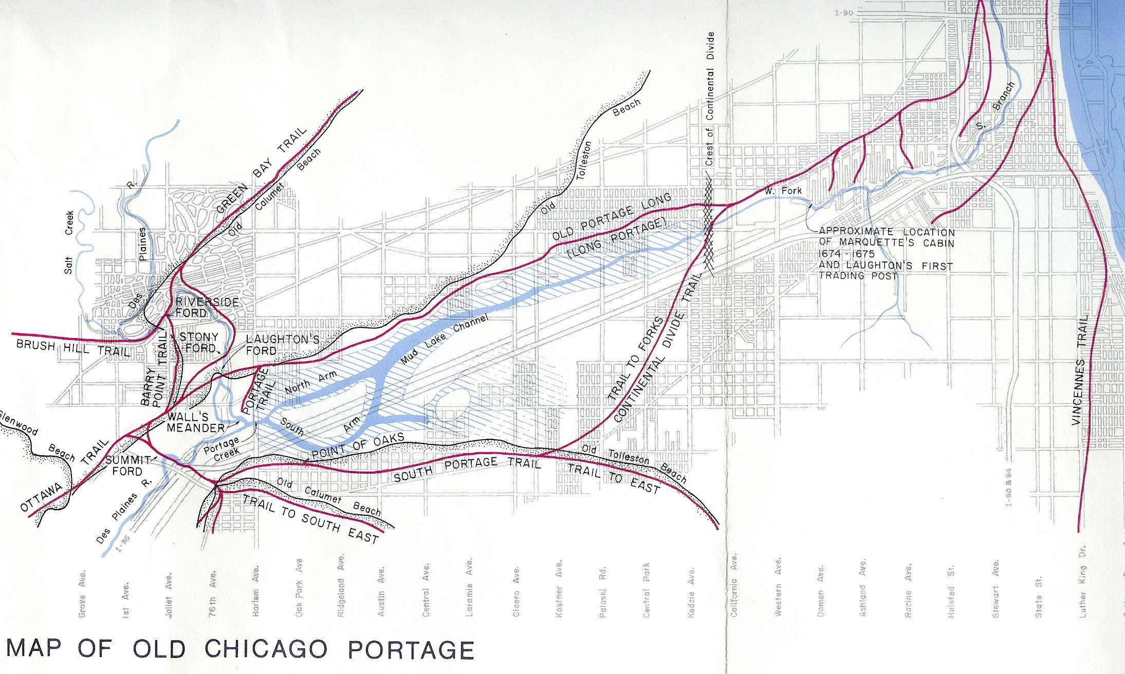
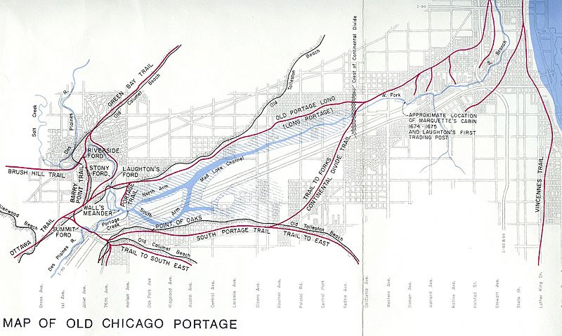
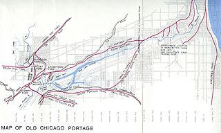
Description: A map of the old Chicago Portage superimposed on a map of present day Chicago. Drawn by Robert Knight as part of a presentation to the Chicago Historical Society on May 1, 1923 by him and Lucius H. Zeuch titled: "THE LOCATION OF THE CHICAGO PORTAGE ROUTE OF THE SEVENTEENTH CENTURY", page 129.
Title: Map of the old Chicago Portage
Credit: https://babel.hathitrust.org/cgi/pt?id=mdp.39015024232657&view=1up&seq=1
Author: Robert Knight
Usage Terms: Public domain in the United States
License: PD-US-expired
License Link: //en.wikipedia.org/wiki/File:Map_of_the_old_Chicago_Portage.jpg
Image usage
There are no pages that link to this image.

All content from Kiddle encyclopedia articles (including the article images and facts) can be freely used under Attribution-ShareAlike license, unless stated otherwise.