
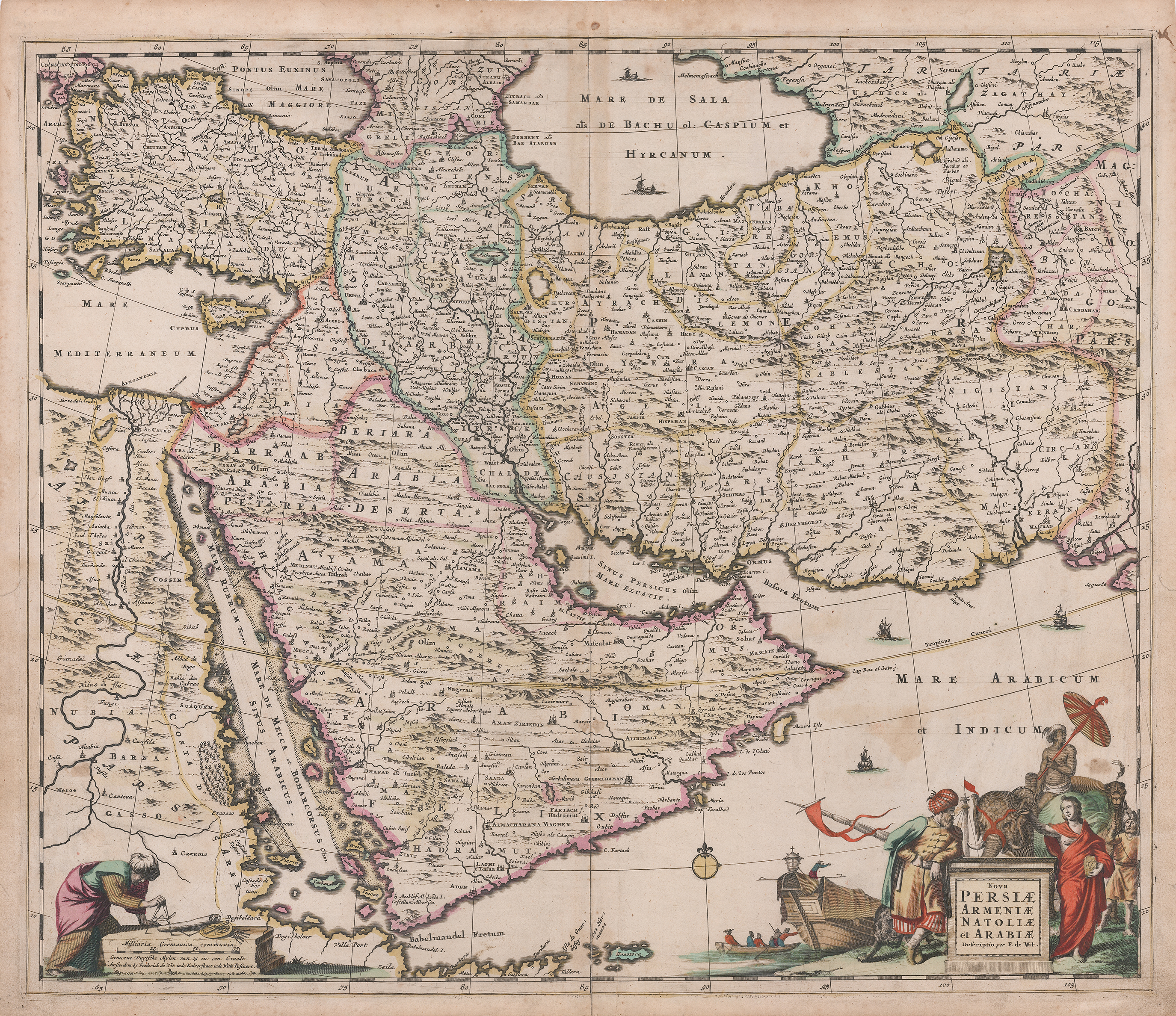
Image: Map of the region bounded by the Saudi Peninsula, Red Sea
Size of this preview: 694 × 600 pixels. Other resolutions: 278 × 240 pixels | 2,749 × 2,376 pixels.
Original image (2,749 × 2,376 pixels, file size: 7.69 MB, MIME type: image/jpeg)
Description: Nice old color example of De Wit's map of the region bounded by the Saudi Peninsula, Red Sea, Nile River, Cyprus, Asia Minor, the Gulf of Aden, Indian Ocean, Armenia, the Caspian Sea, Afganistan and the Indian Ocean, centered on the Persian Gulf.
Title: Map of the region bounded by the Saudi Peninsula, Red Sea
Credit: Own work
Author: Koa-public
Usage Terms: Creative Commons Attribution-Share Alike 4.0
License: CC BY-SA 4.0
License Link: https://creativecommons.org/licenses/by-sa/4.0
Attribution Required?: Yes
Image usage
The following page links to this image:

All content from Kiddle encyclopedia articles (including the article images and facts) can be freely used under Attribution-ShareAlike license, unless stated otherwise.